| Cupboard backpanels finished |
Fly strike |
Surveying
This week I did surveying around my farm in Sweden. On Sunday last week, I started figuring out how to use the surveying equipment. Below is the instruction for how to use it. After the instruction, you find the regular blog of this week.
The assumption for this instruction is that you have a computer connected to the Internet and you got an Android phone, also with access to the Internet. Another requirement is that you are a Swedish citizen; you got access to the personal pages of Lantmäteriet. If you don't have all this, you might still find this interesting to read.
- Log in to https://minfastighet.lantmateriet.se/. Go to the map of your property.
- Click on points:

If you click on the wrong spot, the result will be incorrect. It would have been far better to get these points in a CAD file from Lantmäteriet, but as far as I can see, they do not provide these to private persons, at least not now in 2023. Just click on the correct spot, and you are fine. If fixed points exist in the terrain, then you should use those. For that, see the end of this instruction. - From the information window, copy the SWEREF 99 coordinates.
- Please make a copy of the first coordinate in the list and paste it into the last coordinate of the list.
- Paste the coordinates into the Notepad++ editor, and make a new line for each coordinate pair.
- Open the search and replace window, Ctrl+H. In the Find what field enter this formula: (Ns[0-9]+),s(Es[0-9]+)
- In the Replace field, enter this formula: 2, 1
- Check "Regular expression" and press Replace all. Copy the text.
- Go to this site: https://mygeodata.cloud/cs2cs/
- Click input coordinate system. Select SWEREF99 TM (EPSG:3006)
- Click on the output coordinate system. Select WGS 84 (EPSG:4326)
- Paste the list of coordinates into the input window.
- Click on Transform.
- Copy the transformed list of coordinates into a new window in Notepad++.
- Open the search-and-replace window. In the Find what field enter this formula: ([0-9.]+);([0-9.]+)
- In the replace field, enter this formula: [1,2],
- Add this snippet at the beginning of the list:
{"type": "FeatureCollection","features": [{"type": "Feature","properties": {},"geometry": {"coordinates": [[ - Replace the last comma of the list with this snippet:
]],"type": "Polygon"}}]} - Open this site: https://geojson.io/
- Paste the script into the field on the right side of the window. If there are errors, they will be marked with a red square, and when hovering over them, you will get information about what is wrong.
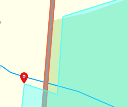
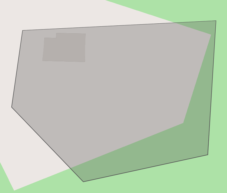
- The map window will display the result. Does it look okay?

- Install the app SW Maps on your Android device.
- Copy the JSON data from the geojson site into a new window in Notepad++. Save with the extension .geojson and transfer the file to your Android telephone. You can use OneDrive to download it to the Download directory.
- Open the file explorer on Android and move the file to this location: Internal storage > Android > media > np.com.softwel.swmaps > Maps > geojson.
- In SW Maps, create a new project. Go to add layers. Add the file as a layer. Now the map is prepared. From here on, it is about getting the equipment up and running.
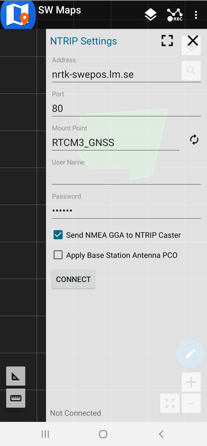
- You need an RTK surveyor kit, like, for example, this: https://www.ardusimple.com/product/rtk-base-rover-calibrated-surveyor-kit. You can get a ten-day sample subscription to RTK data in Sweden. For the rest, it is a pricy hobby. I could borrow the kit and try the 10 days sample subscription. If you got a fixed point on your property, you can use that as a reference point. In that case, you buy two GNSS antennas like in the kit. Be aware of what USB port you have on your phone so that you are not ordering a micro USB OTG cable while you have USB-C on your phone. When using the sample subscription, you need to have a Swedish company or forestry property and an Android phone with access to the Internet. Just so you know, there are a couple of extra requirements beyond equipment only. You can try this tutorial to connect to the antenna: https://www.ardusimple.com/how-to-use-ardusimple-products-with-android-smartphones-tablets/. We suppose you have all these things. Here are the steps to follow to get the RTK data subscription:
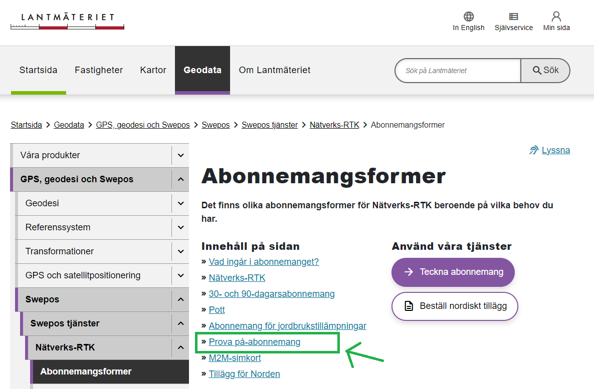
- Go to the site https://www.lantmateriet.se/. I personally searched for "swepos rtk abonnemang". That brought me to the correct page at Lantmäteriet.
- This is the page:
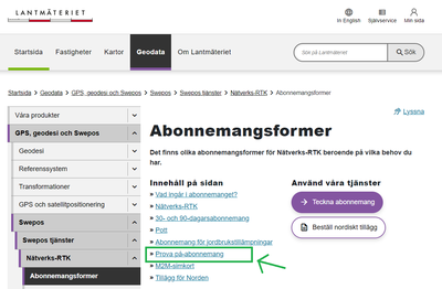
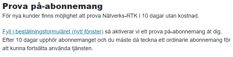
- Klick on "Prova på abonnemang" (Try out subscription). They explain that you can try the service for ten days without charge.

- I will not tell you all the steps here; that would make this a tedious manual. (Huh? It is already tedious!) At the link, you get to the page where you can order the service. You enter your details, including an organization number for a Swedish company or a forestry registration number. Ordering the SIM card is unnecessary because you will use your Android phone. You give a username to use with the service. Then when all is done, you get information via e-Mail. In the e-mail, you get the password you must enter to access the service. You get the link address and port to use to connect.
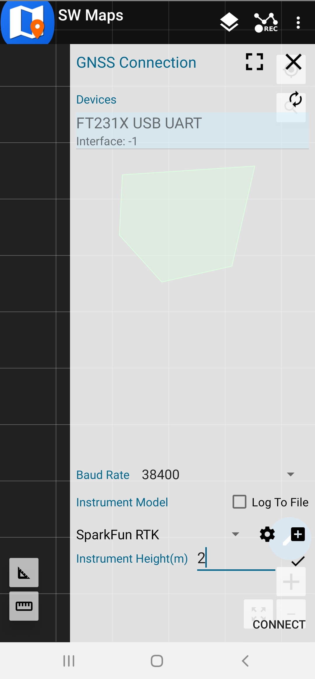
- Connect the telephone to the GNSS multiband antenna via the OTG cable.

- It is essential to select the baud rate, and for the RTK subscription, select SparkFun RTK. Set the height of the instrument in the number of meters. Press connect.
- Activate the main menu in SW Maps again and scroll down to NTRIP Connection. You might need to select another mount point.
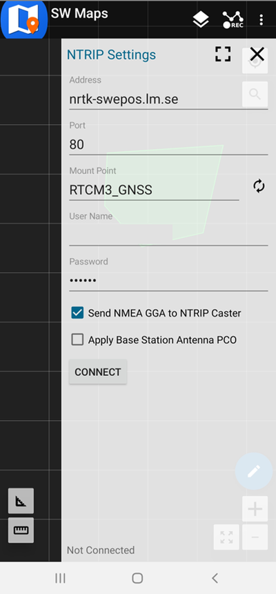
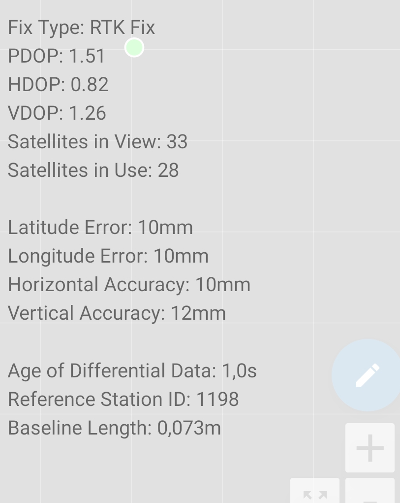
When you press connect, you must verify that the number of bytes per second at the bottom left corner is not zero. Now you are almost done! - When you open the GNSS Status, you should look for latitude and longitude errors. When it works, it should be a couple of centimeters. The Fix Type should be RTK Fix. The dot on the map should be green.
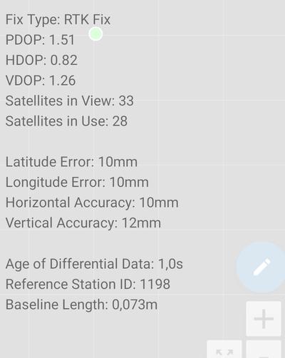
- Now you are okay to go. The precision is within one 5 euro cent coin. That should suffice for most applications.
If a fixed point exists on the property (a stone with a mark on it in a form etc.), it is best to incorporate these into your maps. For that, you need to record the location in the terrain. Put the antenna on a tripod exactly above the feature you want to measure in the SW Maps press record. With a tape measure, determine the antenna height above the feature; this value is entered as offset in meters. Select averaging and wait until the program collects one hundred samples of the point. Now you got the point with the highest possible accuracy. If you gather more points, it can be convenient to name the points. It is now possible to transfer the collected data from Android to your computer. Open the file in https://geojson.io/ to let your polygon use the fixed points.
In my case, I created a new fixed point; I put a cross sign on a large stone on my property. With that point, I can put the reference antenna there, and then I do not need the RTK subscription. Free RTK services exist in other countries, but it has to be expensive in Sweden.
Monday 31 July
We had turned off our alarm clocks to have a slow and comfortable first morning of the holidays. That is not what happened. I woke up at half past 5 in the morning. DW slept for another two and a half hours. I started blogging, finishing the stories from last week. It was beautiful weather this morning. I took for granted that it would stay like that, but that was a mistake. Had I gone out doing the things I had set out to do early in the morning, all would have been really nice, but instead, I was sitting in bed blogging, spoiling the nice weather.
 Almost precisely when I decided to go out, it started to rain heavily. I waited for a while until it was a little less rainy. The idea was to record fixed points in the terrain. There exist stones here marking corners of the property. Here I rigged the antenna to get a precise coordinate of this point. When the antenna is mounted on a tripod, it is stable, and I let the software generate an average calculation over at least one hundred samples.
After I sampled this point, I returned to the cottage and worked on the map data and the documentation. Back in March, I figured out how all this would work. I had great help from the friend I am borrowing this equipment. Now all that was lost, and I had to piece together small bits of information. It would have been much more convenient if I had done that while I had it figured out in March this year. Oh well, I did it again. I got it all figured out again, and this time adequately documented. Eventually, I got all three points recorded with high accuracy.
I also helped DF and DM to mark out their property. It was surprisingly incorrect compared to their own estimates of the borders.
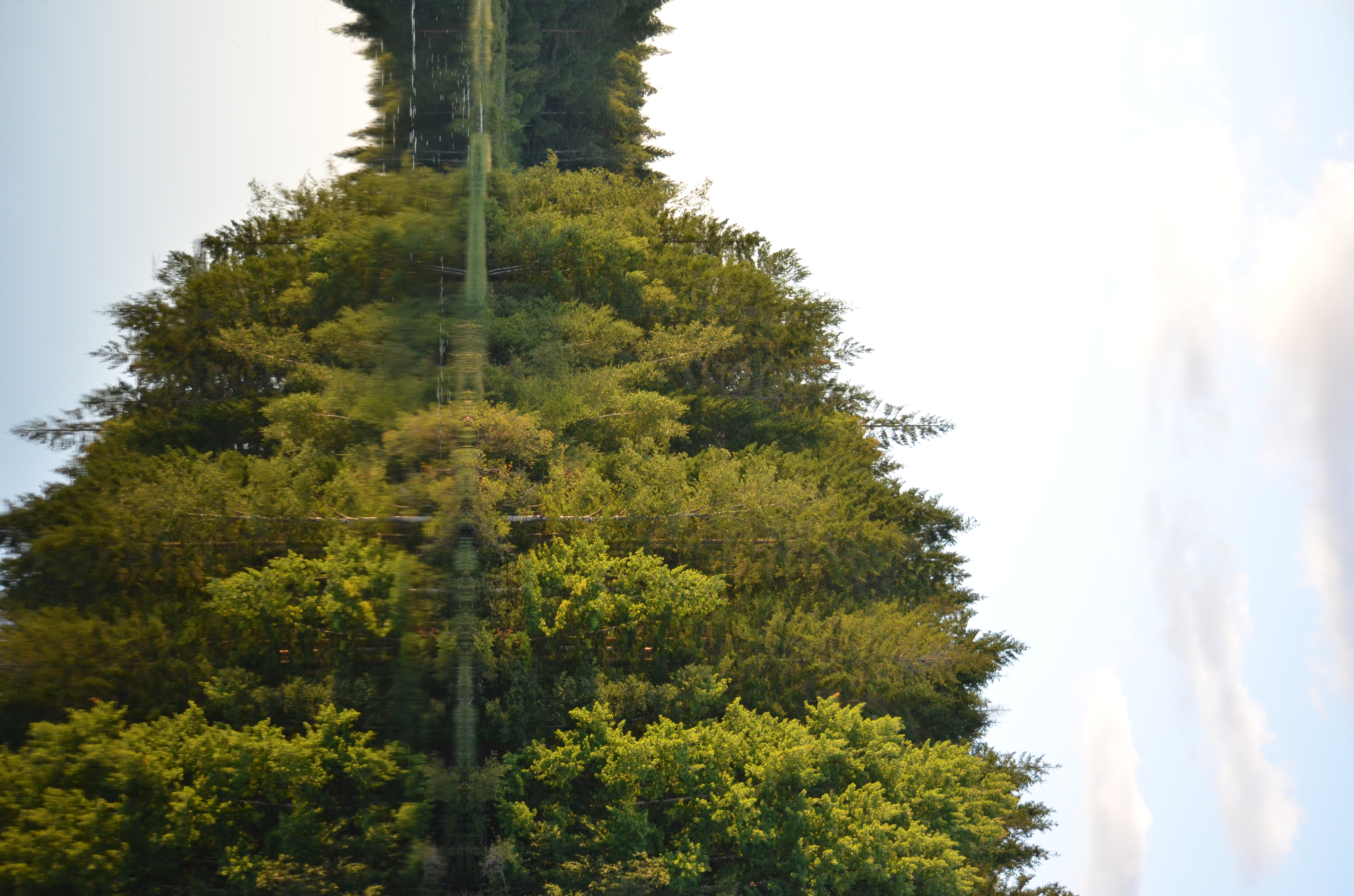
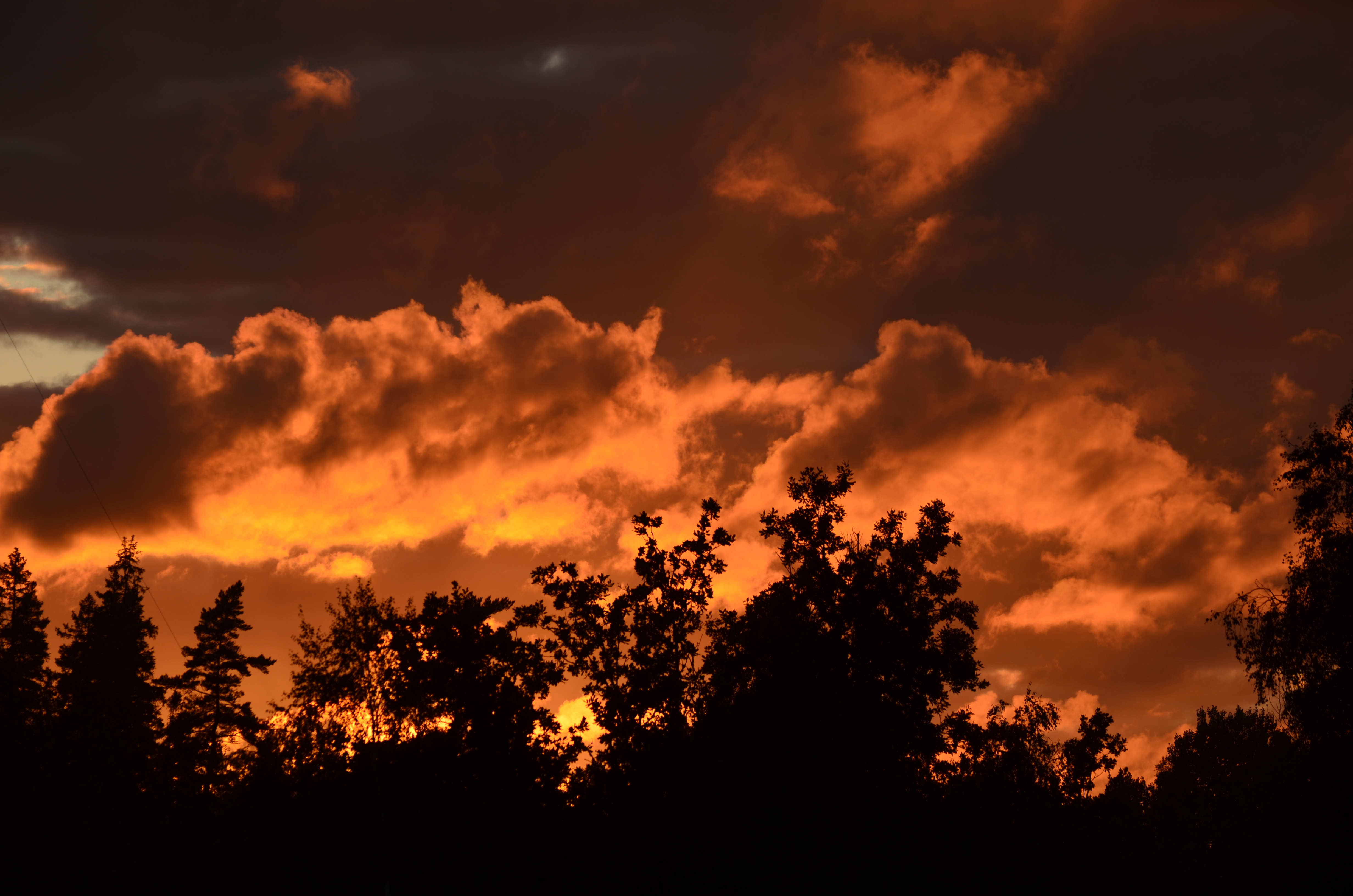 In the evening, there were spectacular clouds at the sunset.
Tuesday 1 August
This morning I started to research if it was possible to get Lantmäteriet to send me the list of coordinates; if so needed, I could pay for it. I browsed through the grand list of products they provide, and I must say it isn't very clear.
Lantmäteriet got a chatbot that is insanely stupid.
They also link to resellers, and then I could browse a list of twenty (plus) resellers of geo data to see what they could offer.
It appears that Sweden will be obliged by the EU to make the geo-information of properties more accessible to the public; see this page. In 2025 it should be possible to get more geo data free of charge. Lantmäteriet has responded to the Swedish government that it will need considerable funding to make these services free. The Swepos service will not be free in the future, though.
 I also found a forum where people discussed geo-data challenges in Sweden. The legal situation was explained very well. In Sweden, no legally binding digital geo data is available for properties. Each property has one or more historical documents in various degrees of resolution and geometry describing where the borders should be. Sometimes there are numeric coordinates in an older local coordinate system, which can be converted with a bit of luck. Sometimes the borders refer to fixed points such as pipes in stones, metal rods in the ground, marks in stones, etc.
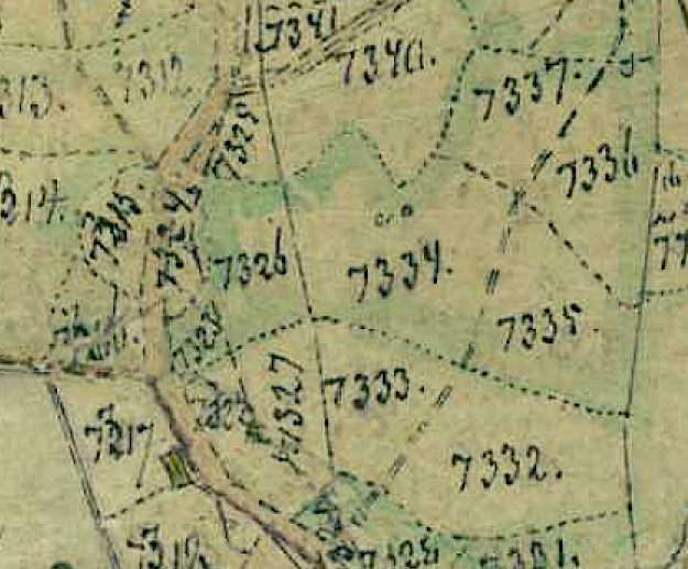
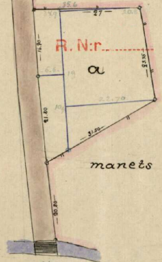 Here is an example of one such document. It is more than a hundred years old, drawn by hand. A little creek is drawn at the bottom of the drawing, and on the left side is a road, curving ever so slightly. The distance to the creek is given. In this example, all would be fine if a little wood bridge was still along the unpaved road, where horses and wagons still travel.
This road has now been upgraded; it is made of asphalt and much broader. In the creek, there is a concrete tube and no wood bridge. This road is prepared for faster traffic, so many little bends and corners have been removed.
The road builders discarded the cornerstones along the road when they broadened it, probably more than thirty years ago. There is no simple way of restoring the borders of the property. There is advanced trigonometry needed. The fact is that this is the legal foundation for the borders and not the geo-data coordinates.
My property originates from about 1800. A couple of chunks were removed from the original property at the beginning of 1900. So many of these historical handwritten documents are in the folder belonging to my property. The geometry of each of these is complex, and many essential fixed reference points have been lost. There is a way to restore all this by letting Lantmäteriet come and make an investigation project. I must pay for that research project; no fixed price is available. They charge 2200 SEK per hour. I start to understand that the challenge here is immense.
The only luck in my case is that there is no dispute. If there is a dispute, then that is the moment when things get complicated. There are fixed points I am not aware of. It would be good to record these.
This was how far my investigation came on the legal situation on Tuesday morning. The rest of the day we went shopping. Our first stop was at the local hardware store; we informed ourselves about buying the official "Rågångsstolpe" from Kebastolpen. The good thing about this border marker is that it is the standard marker to use in Sweden but is also good quality. It can withstand a forest fire. If we bought PVC pipes, they would work well but be gone after a fire.
Then we went to the second-hand shop as usual on Tuesdays on our holidays. That almost appears to be a tradition by now.
You cannot find everything you need at a second-hand shop, so we went to a paint shop. I was curious about what you can use instead of the official border marker. I was tinkering about using metal rebar. A rebar would be virtually invisible due to its rusty original color, and if one walked into one, it would hurt a lot. Probably the top of the rebar would be sharp. It would have been nice if one could paint the rebar brightly. So we went to the color shop, and it became clear that it was all possible, but the paint was not cheap and would require the metal to be clean. One could go for rust paint, but it is also not cheap. Covering the sharp top would be good if one mounted something on the rebar. How about a tennis ball? Whatever we chose, it had become a tedious project. The official border markers did not appear so bad after this investigation.
Since we were near the Smålänningen market, we also went there. They had rubber boots. I suppose the British call this footwear for Wellington. DW bought two pairs. We also bought rain trousers for me. That would come in handy when walking around the terrain.
We went to a farmer's supplies shop. They had the Kebastolpen border markers for a reasonable price. Now it felt like we were equipped to mark out the borders of our property.
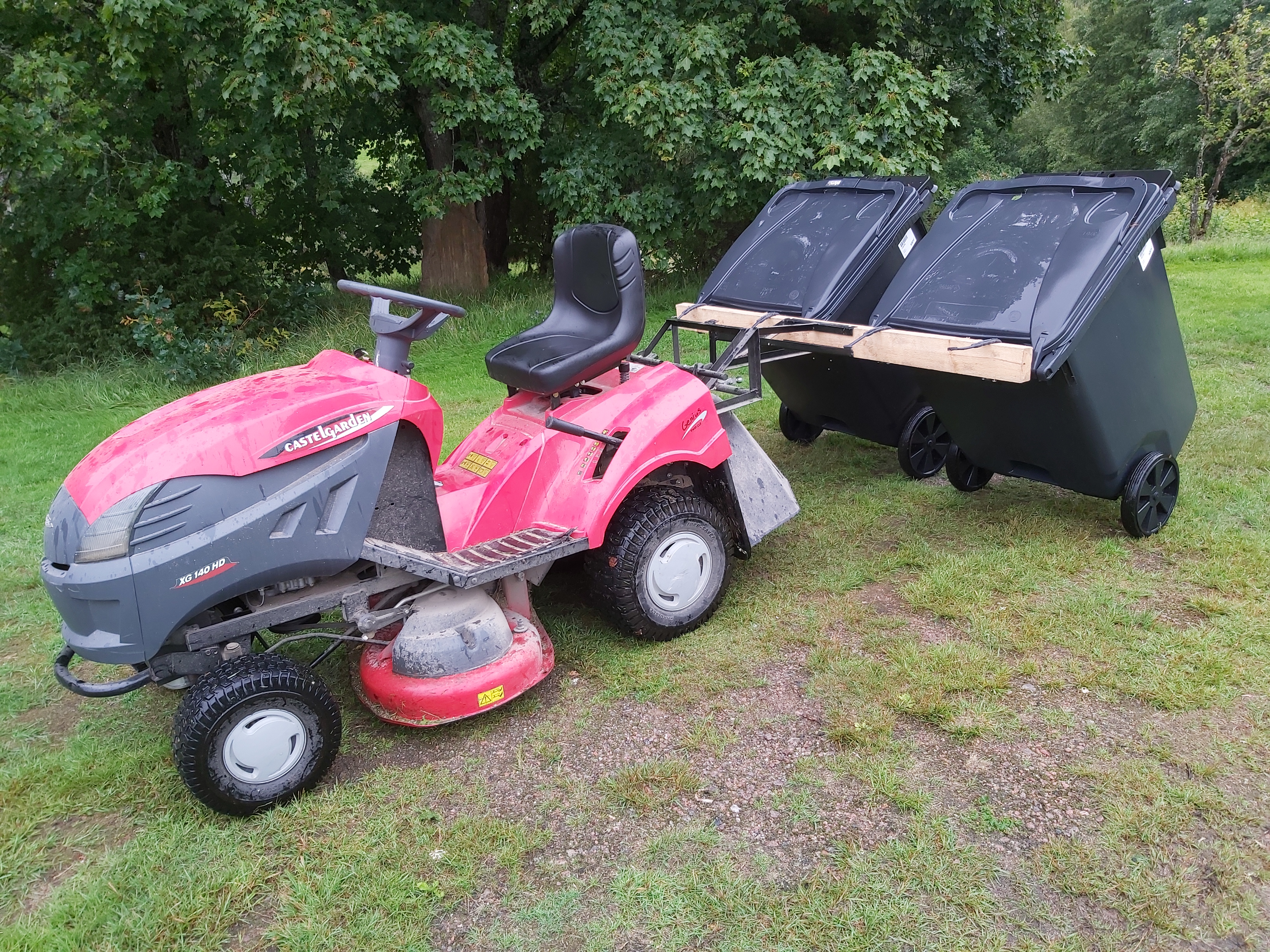 We were tired when we came home from our shopping tour, and it rained extensively. In the last moment of dry weather, I mounted the garbage container transporter on the moving tractor. We need to bring the containers to the main road. It is convenient to bring the containers this way. When rolling the containers manually, it becomes a major operation. Especially if the containers are full. While at it, I cut the grass of the middle part of the road. I love it when the grass is in the middle of the road, but it must not be tall.
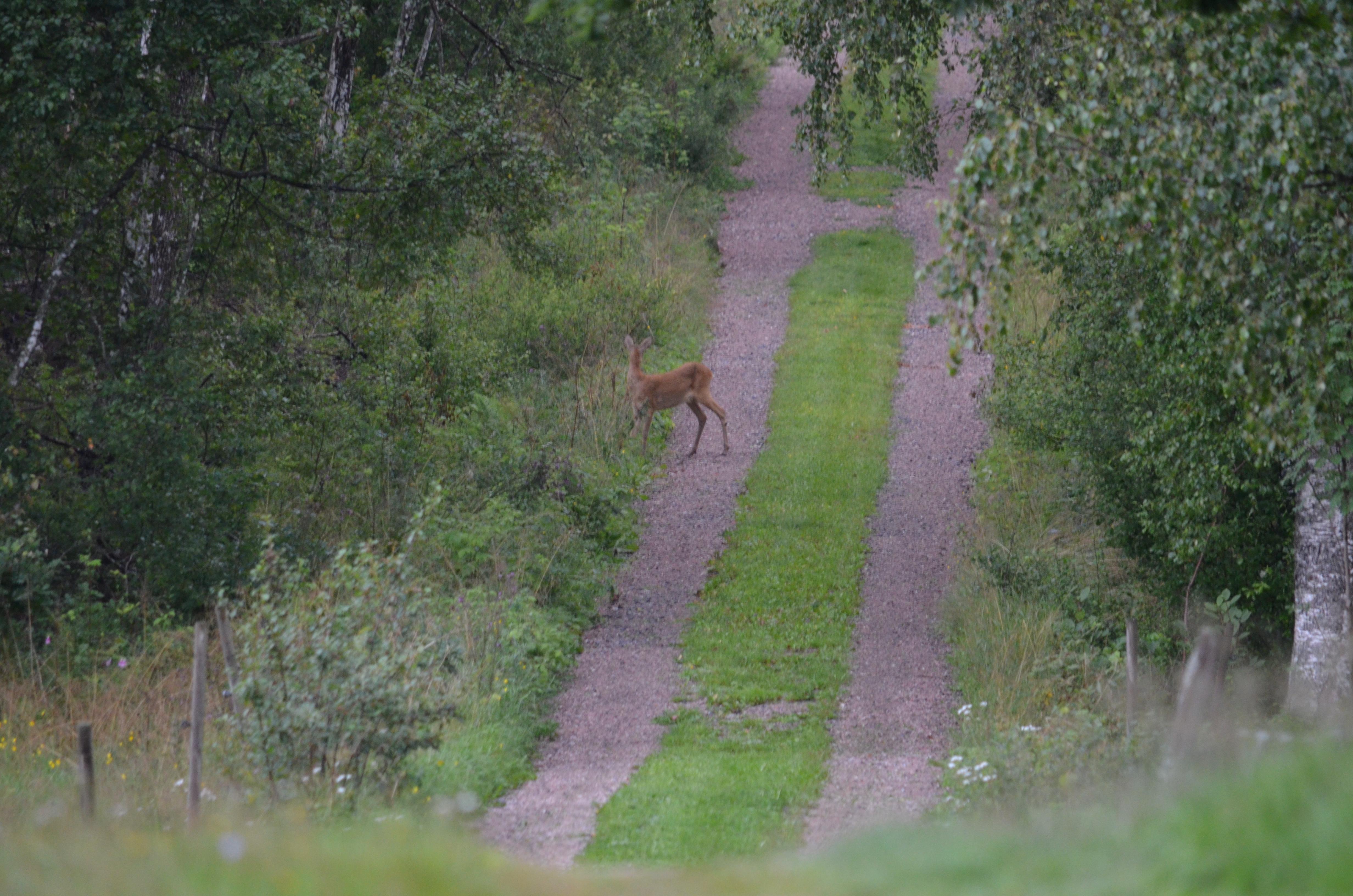
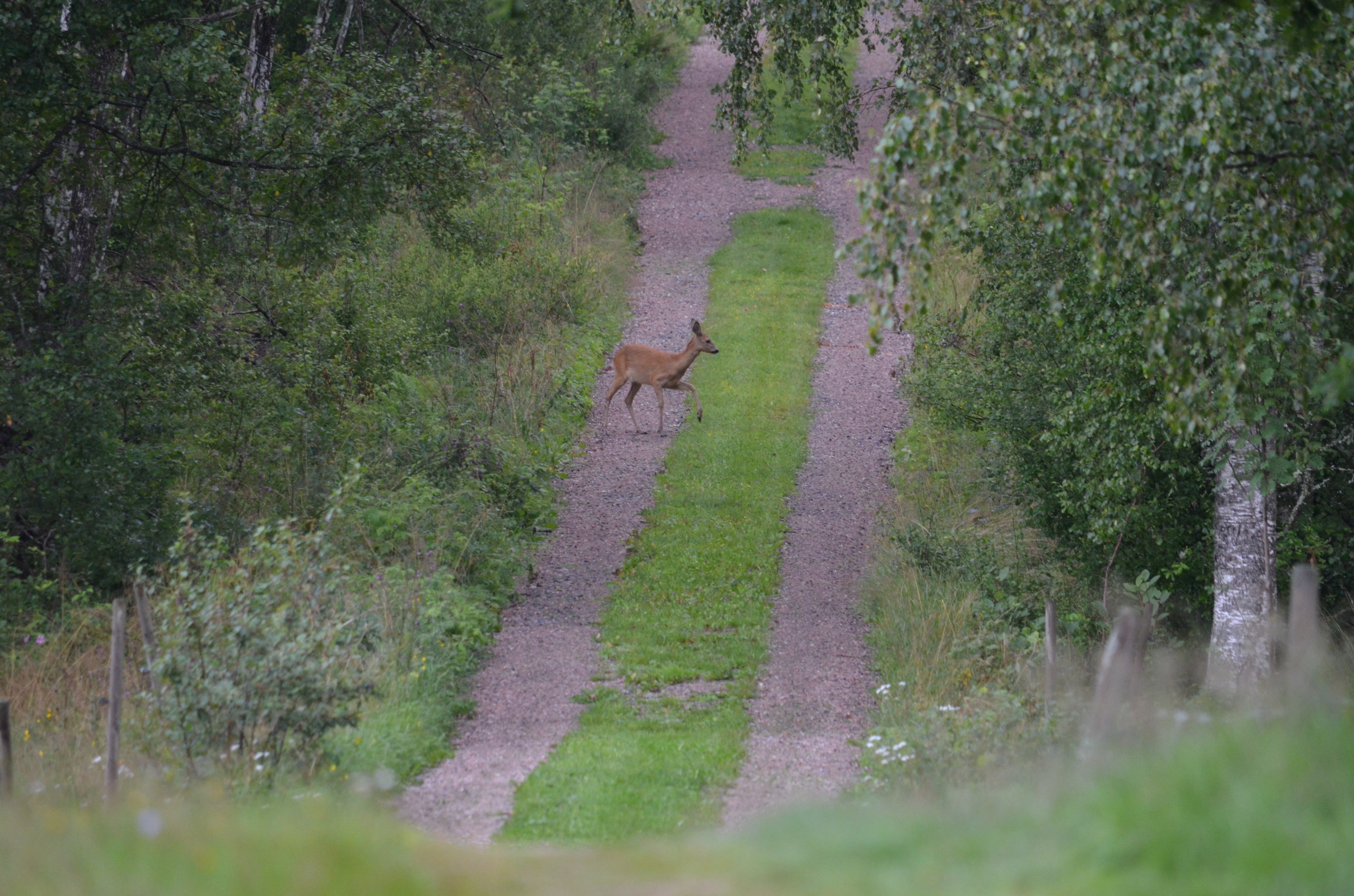
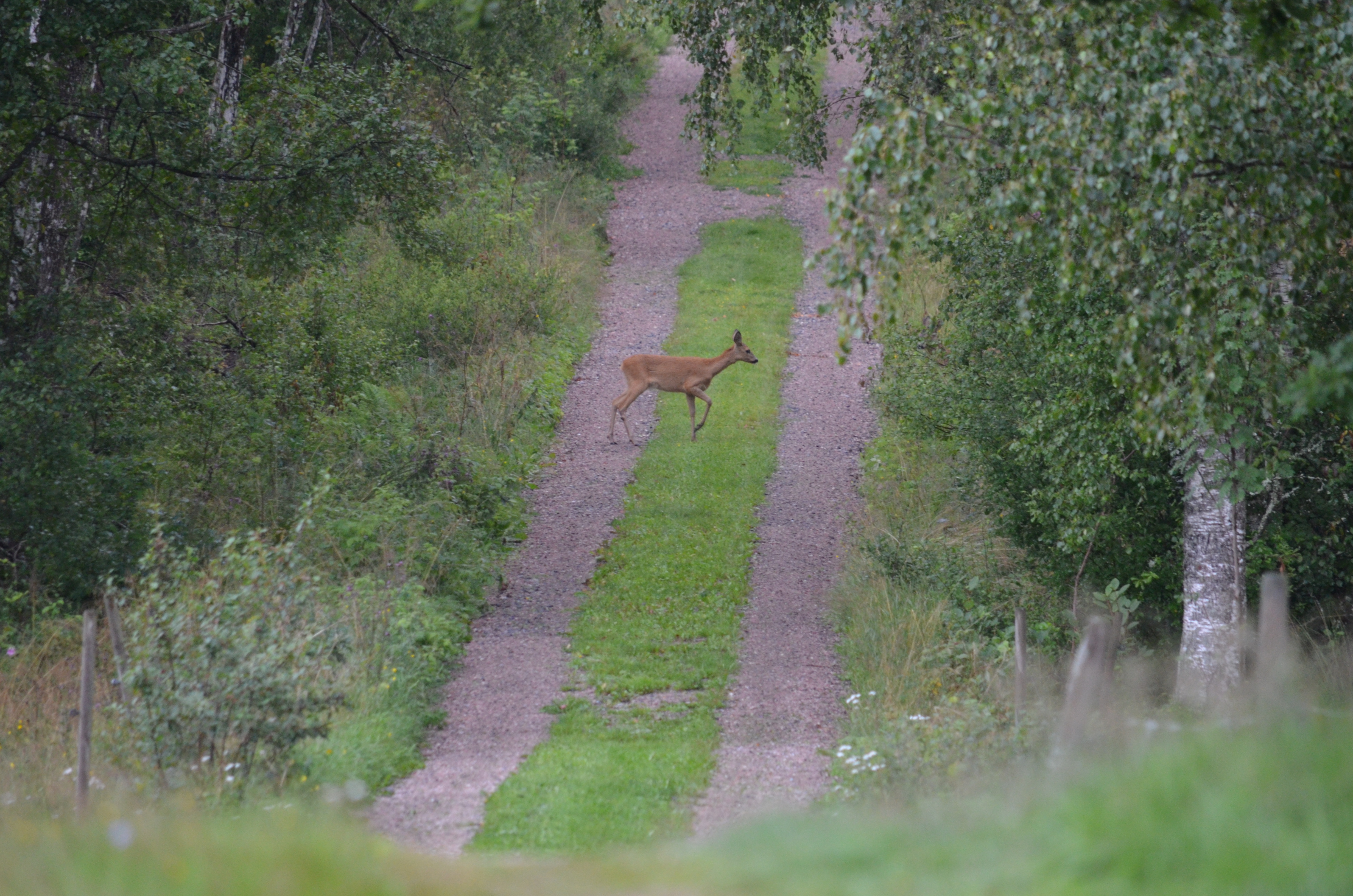
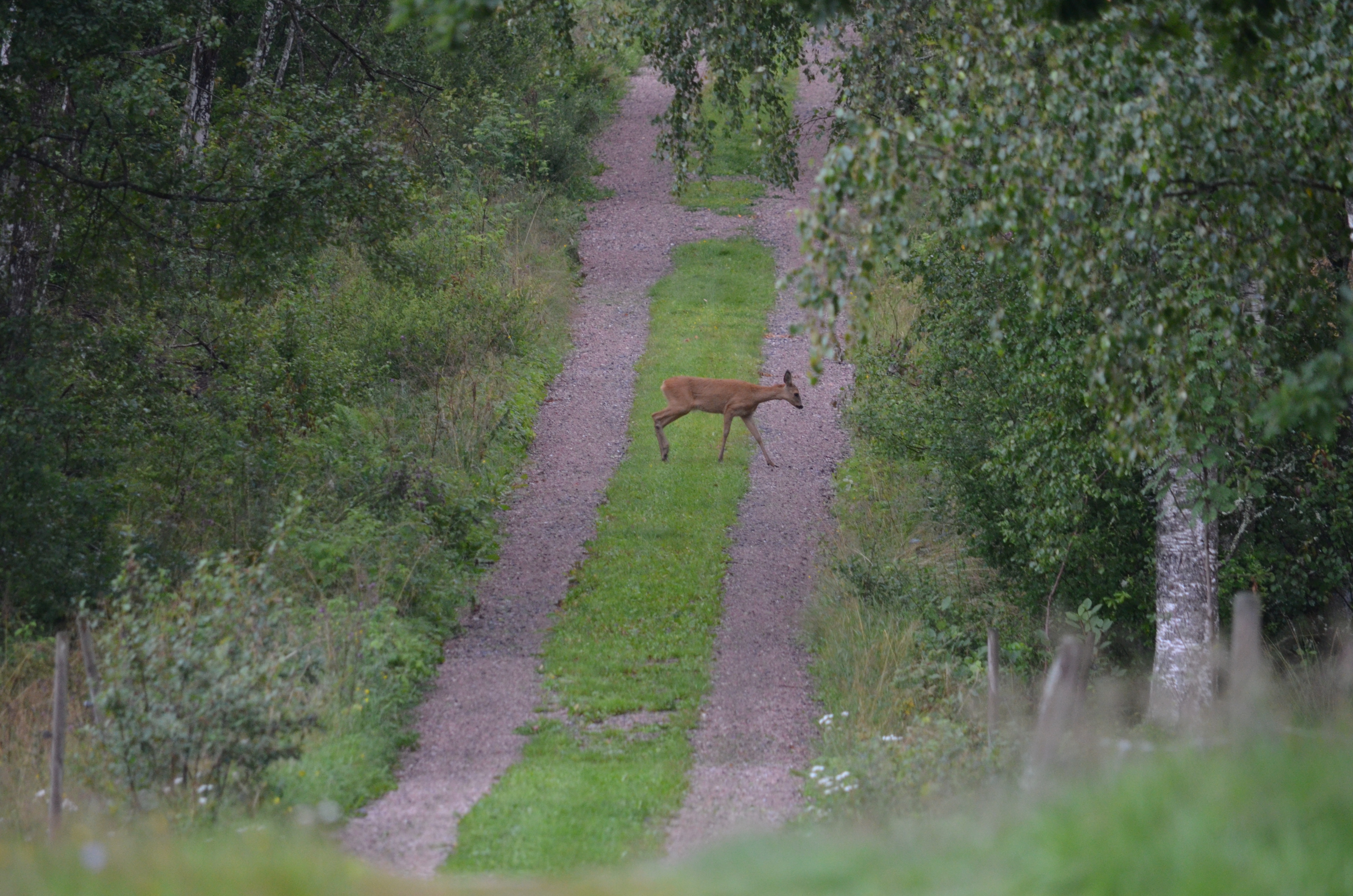
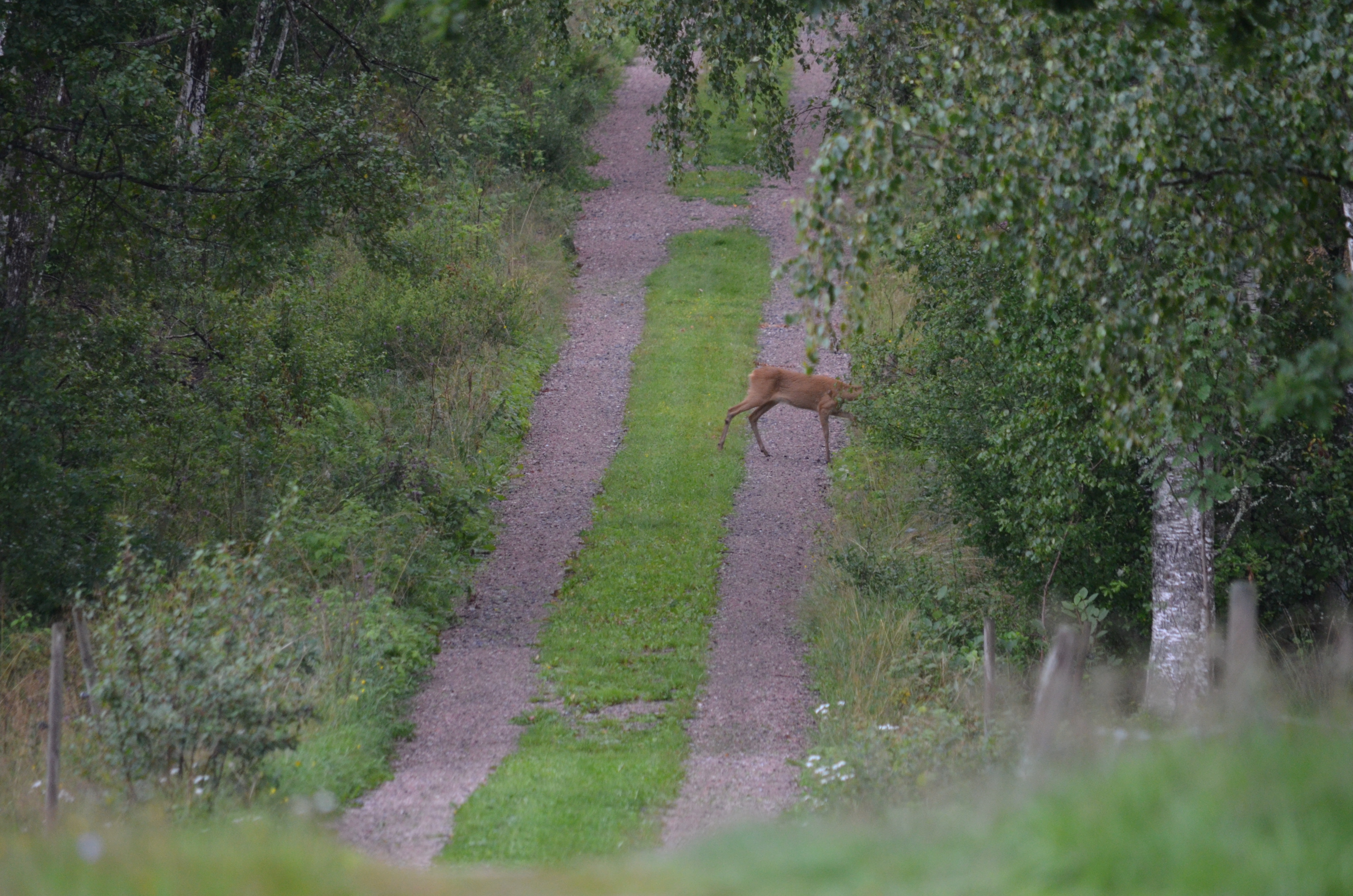
In the evening, I spotted one roe deer!
|
|
|
|
|
|
|
|
|
|
|
|
|
|
|
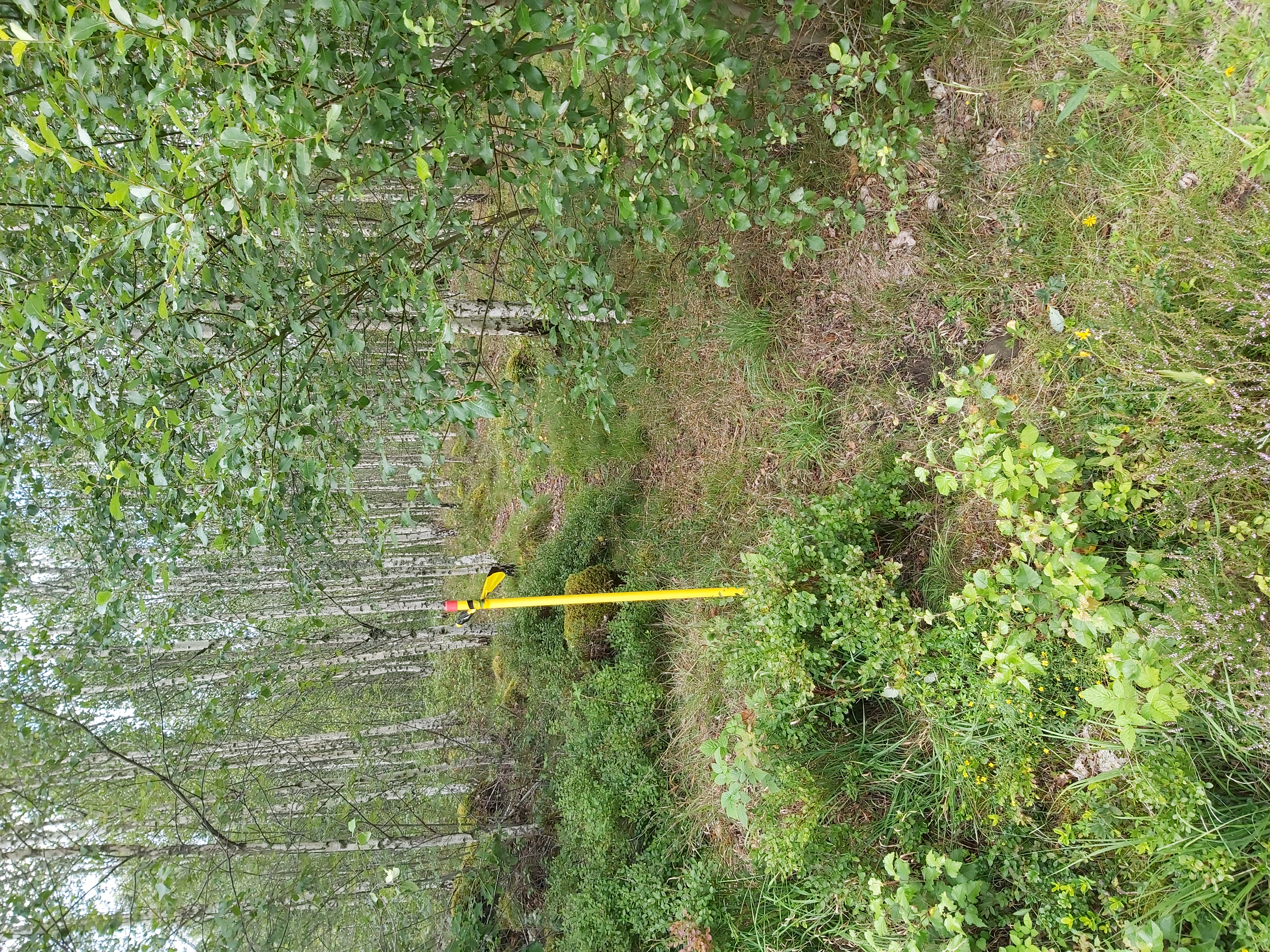
You can see how nice the middle part looks when cut. We carried out maintenance on the road in April this year. Back then, I was sure I had damaged the grass in the middle part. When I see the result, I am pretty happy with the look.
Wednesday 2 August
Today it was a really nice weather. The forecast initially promised rain, but it was sunny! I decided to mark the west border of the forest near the little lake. In the most dense bushes, I lost a little pin used to secure the height of the antenna. I was devastated; how would I explain to my friend that I borrowed it from? I asked the company if they could send me a replacement pin. We will see how that goes.
When I realized I had lost the pin, I also lost contact with the antenna. That was perhaps a far worse issue. I went back to the cottage to reassess the situation. I could not complain about the weather, though; it was fine. There had been a slight drizzle, but that was for a short moment, so I was not too worried about that. The moisture in the vegetation was, of course, a slight concern; there could be a droplet falling from a tree.
I had two antennas, one for the reference point and one for the surveying. The reference point antenna is unnecessary when connected to the NTRIP SWEPOS subscription. That is how I use the equipment since I still got the ten-day try-out subscription. The redundant antenna was still at the cottage. I connected the redundant antenna, and it also did not work. That was good news because it was not the fault of the other antenna I had been using. Then I connected the phone to the charger, and it started charging, so the USB port was not broken. That was also good news. Then I only had two components left: the OTG cable and the corresponding USB to Micro-USB. I had no practical way to test these. I figured that the error had to be moisture or dirt related in the port of the OTG cable. I cleaned these carefully with tissue. I got the antenna working!
 I celebrated this success by going out in the nice weather and continuing my surveying. I was fully equipped with everything from official border sticks to a functioning surveying kit. I even had a hammer to hit the sticks with, but most of all, I had sunny weather. It was nice. I put the Kebastolpe on open terrain and tied plastic bands in compact bushes. I am not using that many border marks this way, so one bag of 20 will probably be enough for this vacation.
Returning to these borders and clearing the worst bushes will be good. It had been excellent to open the border, making it visible in plain sight. Oh dear, another TODO item for the long list of things that needs to be done at the farm.
Thursday 3 August
This morning my neighbor called me because he had arrived at his cottage. We decided to meet later today, walk around, and try out the surveying kit.
Before going to the neighbor, I bought marker spray at the local hardware store. Now I had all equipment I could possibly think of necessary to survey. The marker spray makes marking fixed objects besides the stick and the tape possible.
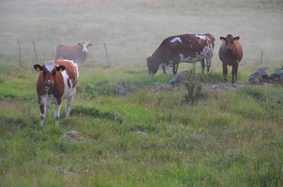
Then I went to the neighbor; he came out of his cottage with a charming black nose. He had been making a fire in his woodstove and accidentally wiped his nose afterward. I did not say anything of his appearance, not that I looked especially fancy with my jeans with holes, large wellingtons, and a worn-out jacket. He extracted his large wellingtons from his car, put them on, and then walked out to the lake together. But first, he fished out a can of bear from his jacket. He did not offer me a bear. He showed me a new fixed point I was unaware of at the lake. It was a hole in a stone.
While walking in the forest, he told me about two official surveys with contradictory results forming the legal foundation for the property's borders. 1879 the area was reshuffled, and 1953 revisions took place, apart from various other adjustments. Some of the changes contradict each other. According to my neighbor, there are fixed points from the 1879 survey that the 1953 survey disregards.
We went around and inspected the various points. There should be one more point, but my neighbor had not been able to find it. I could not help him with that either.
Then I set up the equipment and registered the fixed points he had told me about. He also knew that the previous owner of the adjacent property was an explosives specialist, and he had the equipment to drill in stone. This means that just because a stone has a hole around here does not mean it is an official mark. Good to have that debunked.
The previous owners of my property had been in legal controversies with the previous owners of my neighbor's property. Apparently, there had been several long-running controversies.
My neighbor could also show me the remaining fixed points of his property. There should be four points in total, but only two are left. The other two are missing because the road has been made wider.
We had been walking around the forest and the lake for some time. My neighbor's nose became cleaner every time he wiped it. Then we said goodbye to each other. I promised to send him a map file. We will see if he appreciates that.
Friday 4 August
Today I had the feeling I wanted to finish surveying the part near the lake so that I could regard it as finished, but it occurred to me I had been too focused on the data I had at hand when starting the project. The talks with the neighbor yesterday taught me that some points are legally binding in the real world, not the world of a website with a digital map. I had put out two poles that conflicted with the real world. There are also conflicting points in the real world, but let us not add to the already available confusion.
In the old world, hand-drawn maps from 1879, in my case, meets new technology with a ten by seventeen-millimeter precision (about a half square inch). But the precision is of no good if the input data is unreliable. It is, however, possible to do clever tricks with the new technology that you cannot do with only a compass and a tape measurement. One straightforward thing is to make a straight line through any terrain.
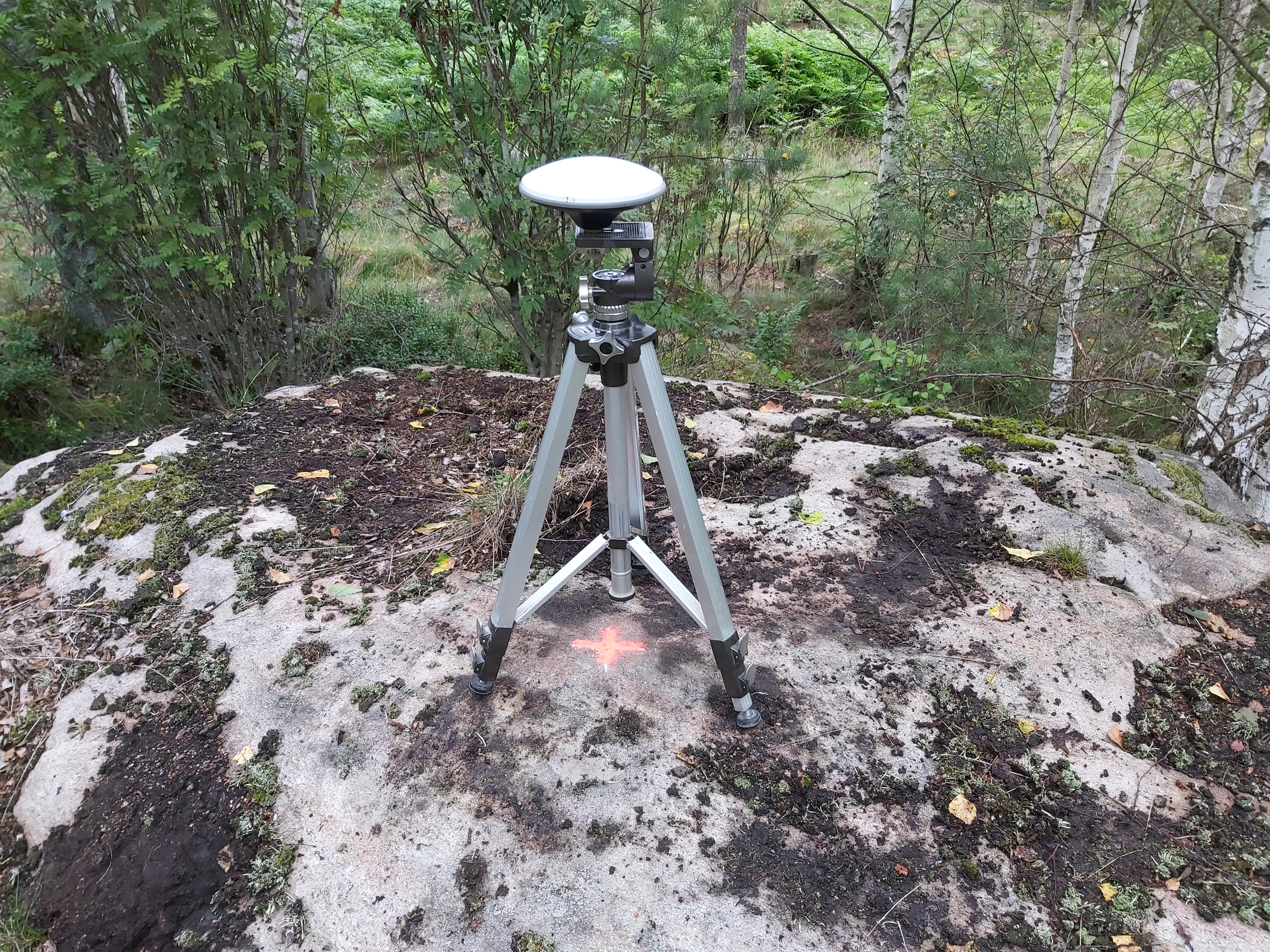 I removed two conflicting points I set out yesterday. With that out of the world, I could continue with the tasks. I set out a new reference point surveying point. As I probably said several times, I use the SWEPOS NTRIP subscription. It is a ten-day free subscription that will end next Tuesday. When that has expired, I need to use good reference points. What I want are convenient, good points. I have created a point next to the outdoor fireplace at the cottage. I made a cross in a stone. Theoretically, it should cover the entire property, but I am unsure. Extending the range with an external antenna at a higher position is possible, but it is all just theory. This is why I want to have a few extra convenient reference points. On a central point on an open hill section, I had the bedrock of the mountain poking up through the soil. I chiseled a cross into the stone and painted it with a bright marking color. It will be possible to return here and set up the equipment again.
Then I went to the other side of the property. Here I wanted to increase the pace of the surveying. It is taking so long to do this. I decided to start with the digital map reality and see if that matched anything in real life. I got such a great surprise! It matched precisely within millimeter precision. A shallow trench had been dug into the ground, indicating the border. This went perfectly well to the end; at the end of this trench, there was a pole. I planted a new Kebastolpe pole next to it.
 Here in this stretch of the work, I lost the yellow and black tape I had been using. That was frustrating. Instead of sitting down and giving up, I pushed ahead. I switched to the marker paint I had bought the other day. At small trees I found precisely on the border, I gave them a bright marker.
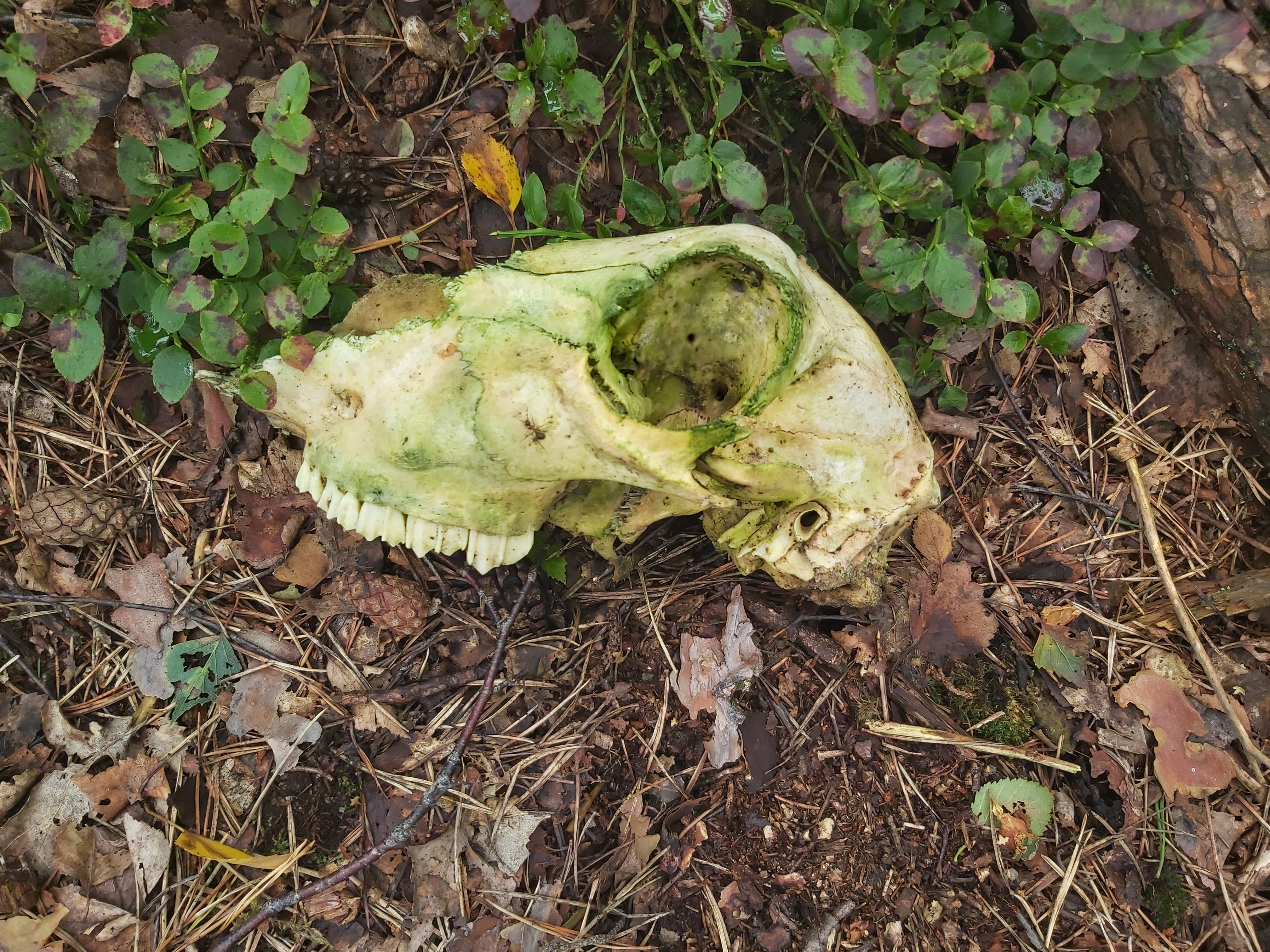
I searched for the tape, but finding something yellow and black is challenging when the ground is black, and some leaves are yellow. I did find a skull of a dead animal!
Saturday 5 August
Yesterday I had a sore feeling in my knees. It is reasonable then that we decided to do something else today. We are going to a second-hand shop, and we will go to a local museum. We are walking around, but that is on flat surfaces, so I hope I have a chance to rest my knees.
When I woke up this morning, I thought entering the coordinates in a CAD program would be great. Then it will be possible to annotate the points and make calculations based on them. That way, I can find where lines should meet or make circles with a specific radius, and where that circle meets another, we perhaps have a new calculated corner point.
The calculated points can then be set out. So now I am wondering what cad program I can use. I have long experience using Fusion 360, which is free for hobbyists, but in this case, I think it would be better with another program that is better at geolocation.
I do think 2D is sufficient for me right now. It would be nice to be able to keep the height data, although not have support for it. This will be a research project for later when it is raining. On Sunday, it started raining, and then I figured out that SketchUp versions allowing to import of DXF files come with a license, so that ended the SketchUp idea.
We went to the second-hand shop well on time. It had cheaper prices and more exciting things. I bought two three-phase cables, a T-shirt and a sweater. DW found books, cups, knitting needles, and a tray for knives and forks. It was successful.
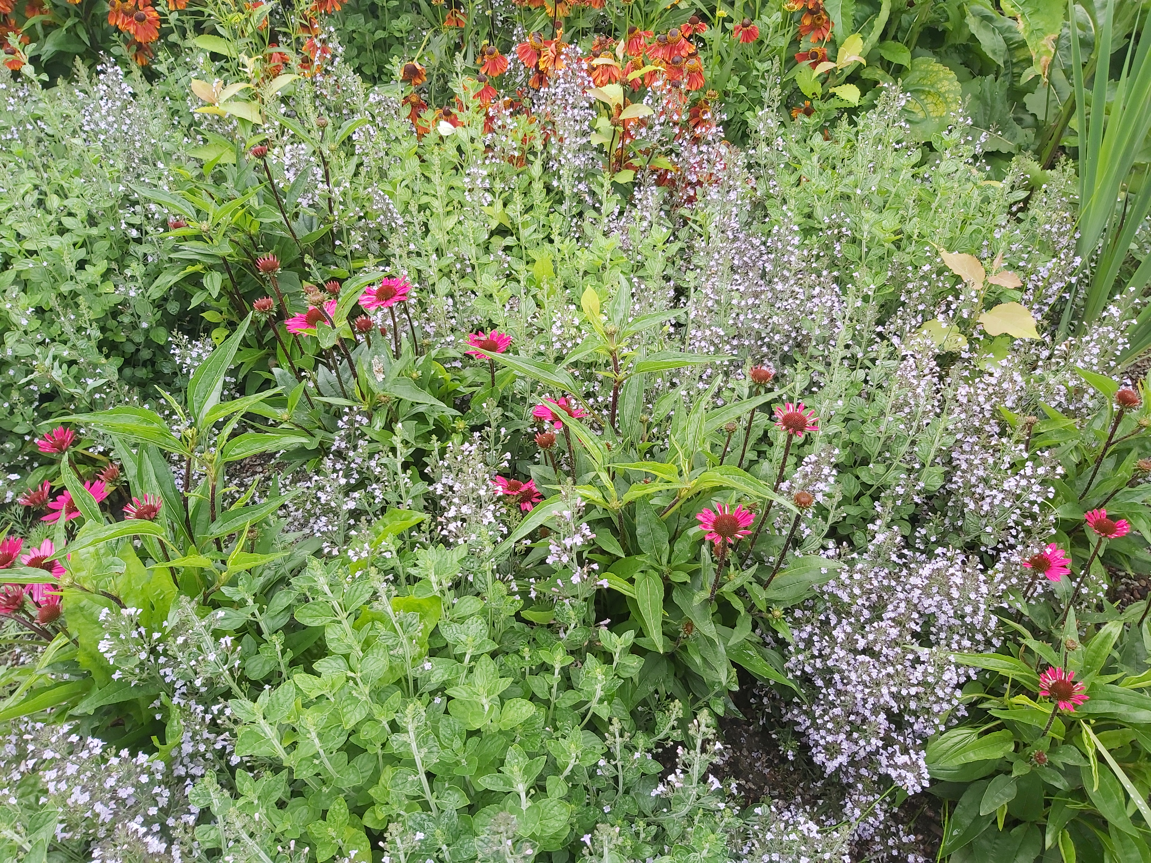
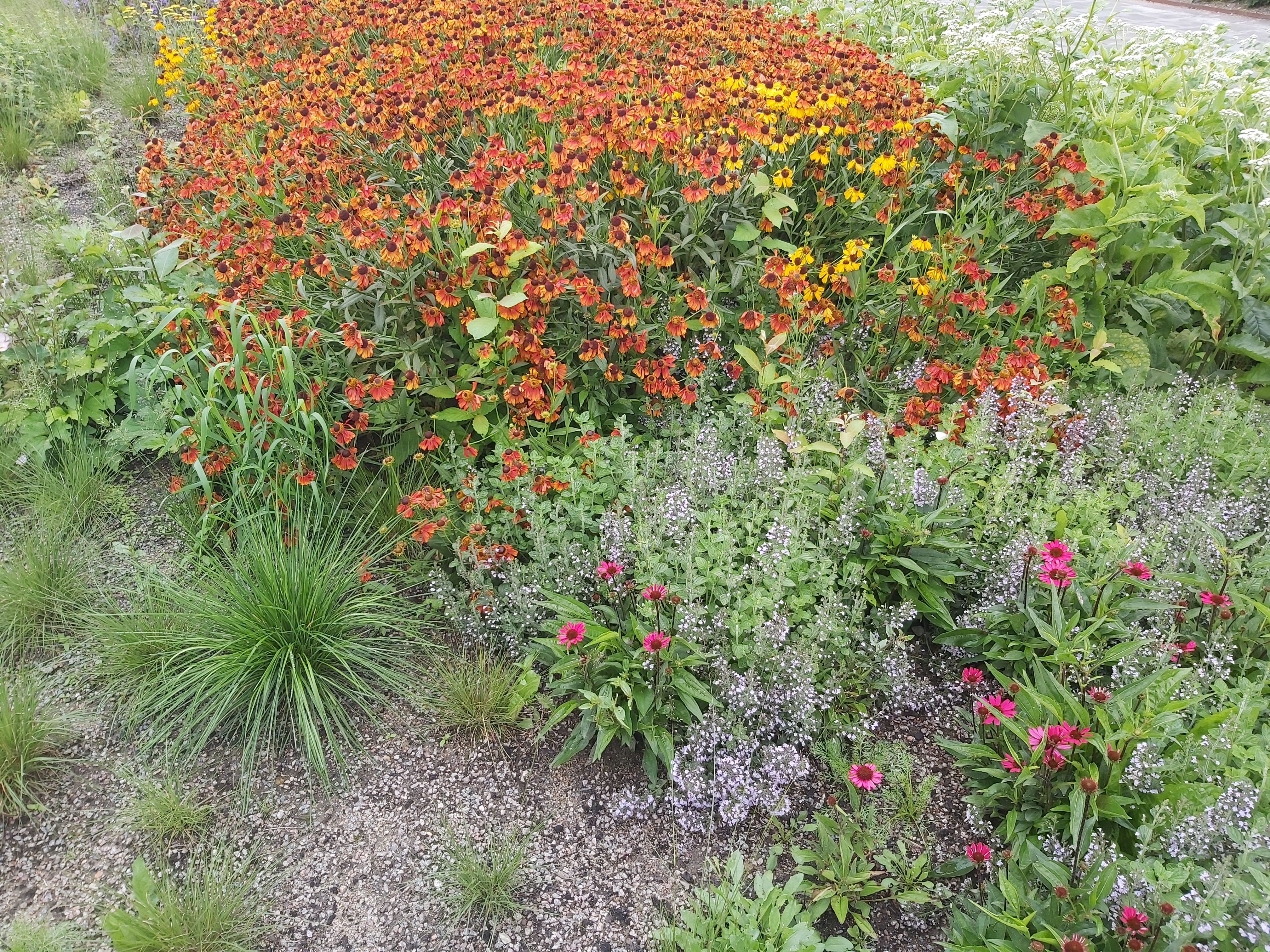
Then we went to the local museum. Outside the museum, they had a new garden. It was nice!
|
|
Indian pokeweed |
|
|
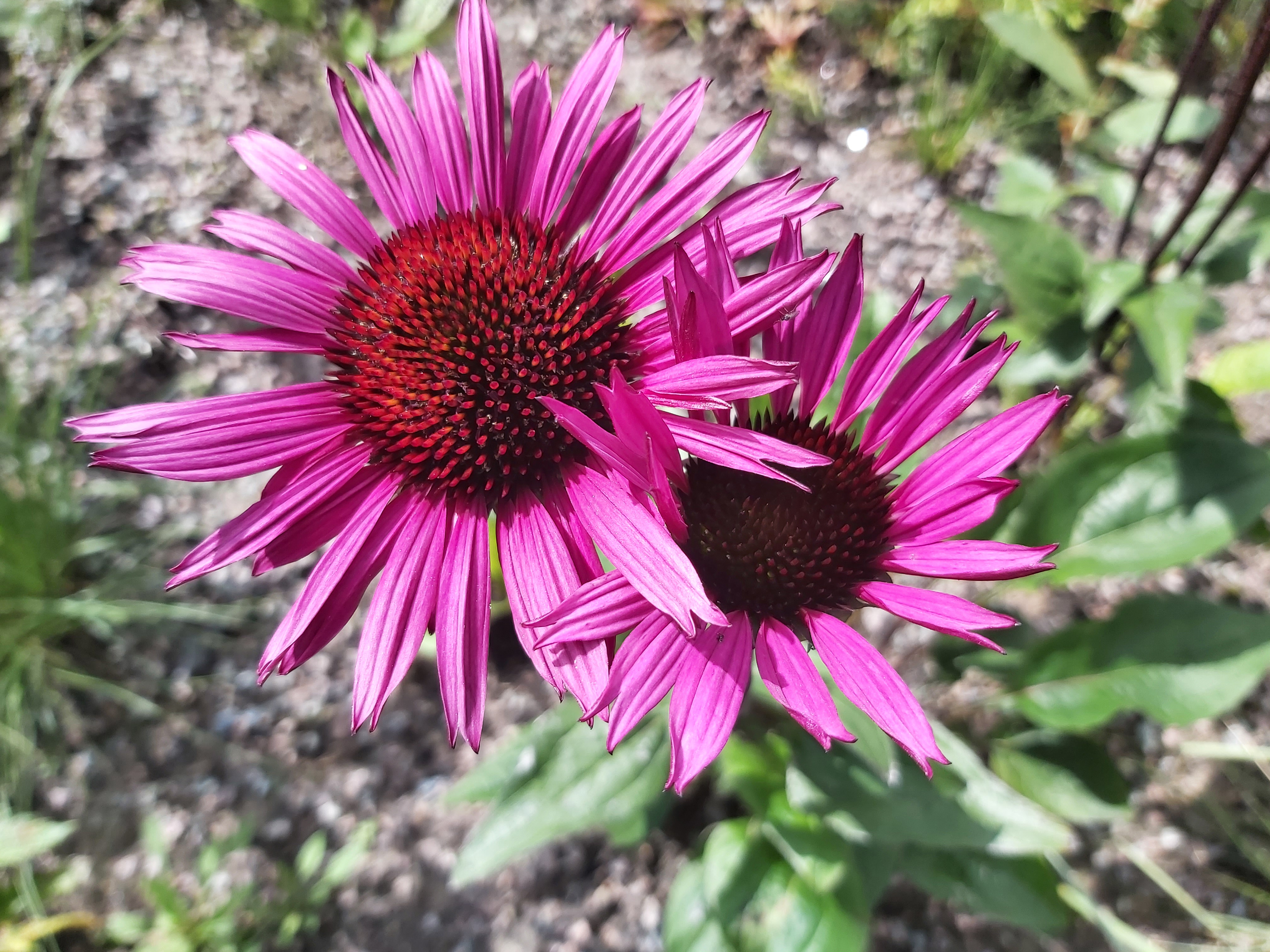
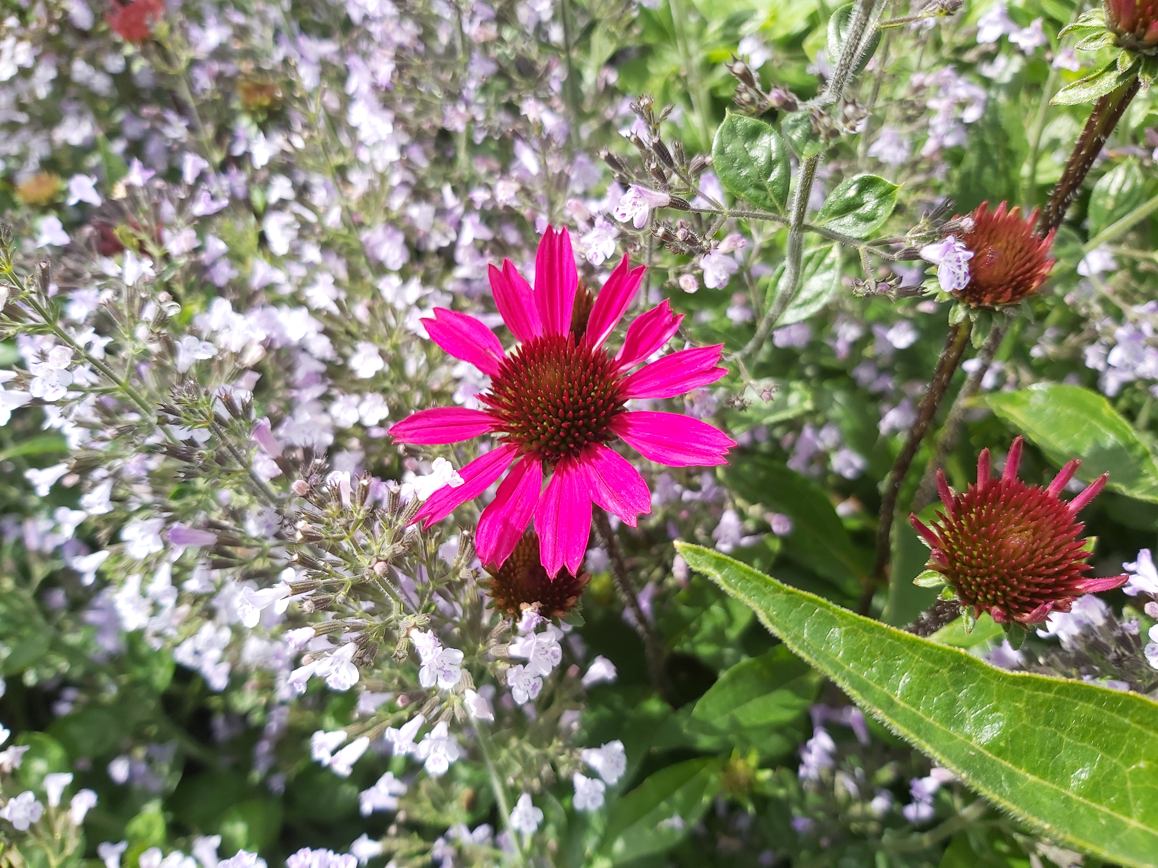
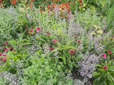
Cone flower, Echinacea sombrero. |
|
|
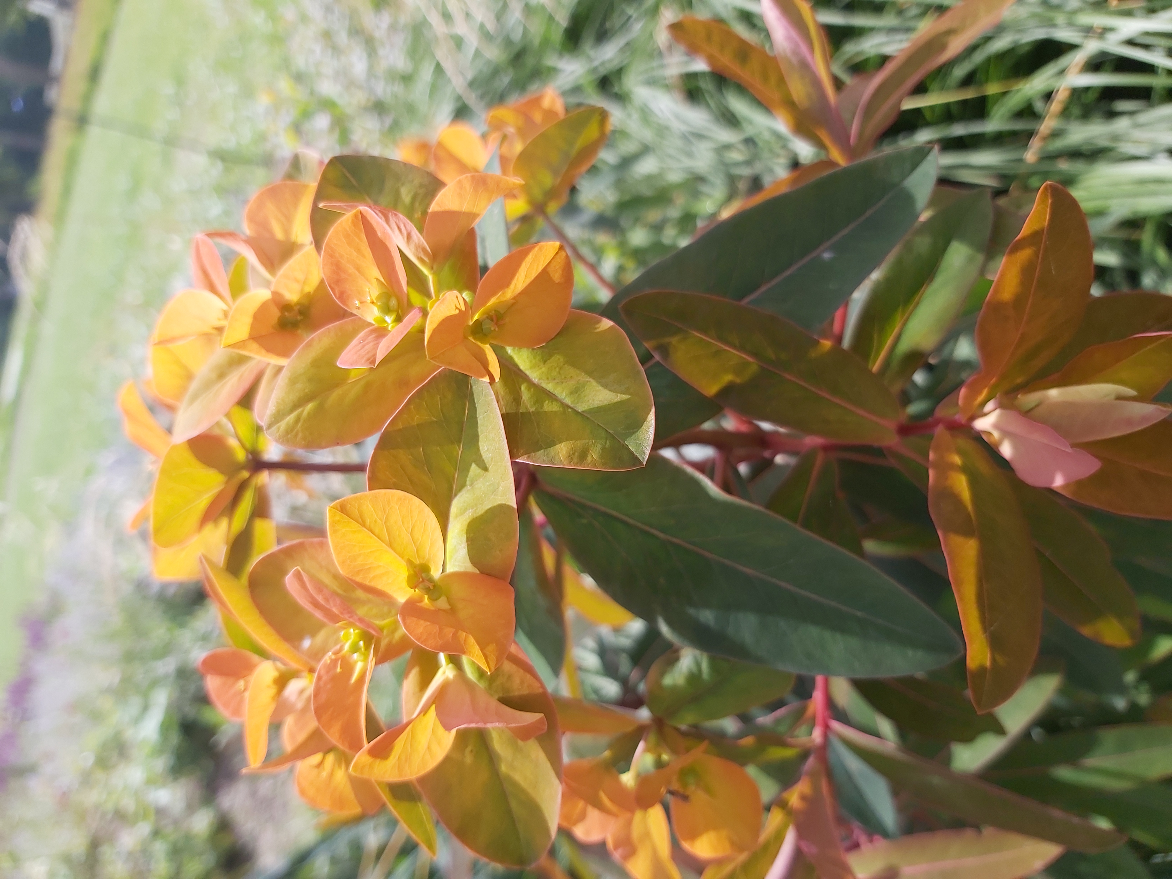
Broad leaved spurge. |
|
|
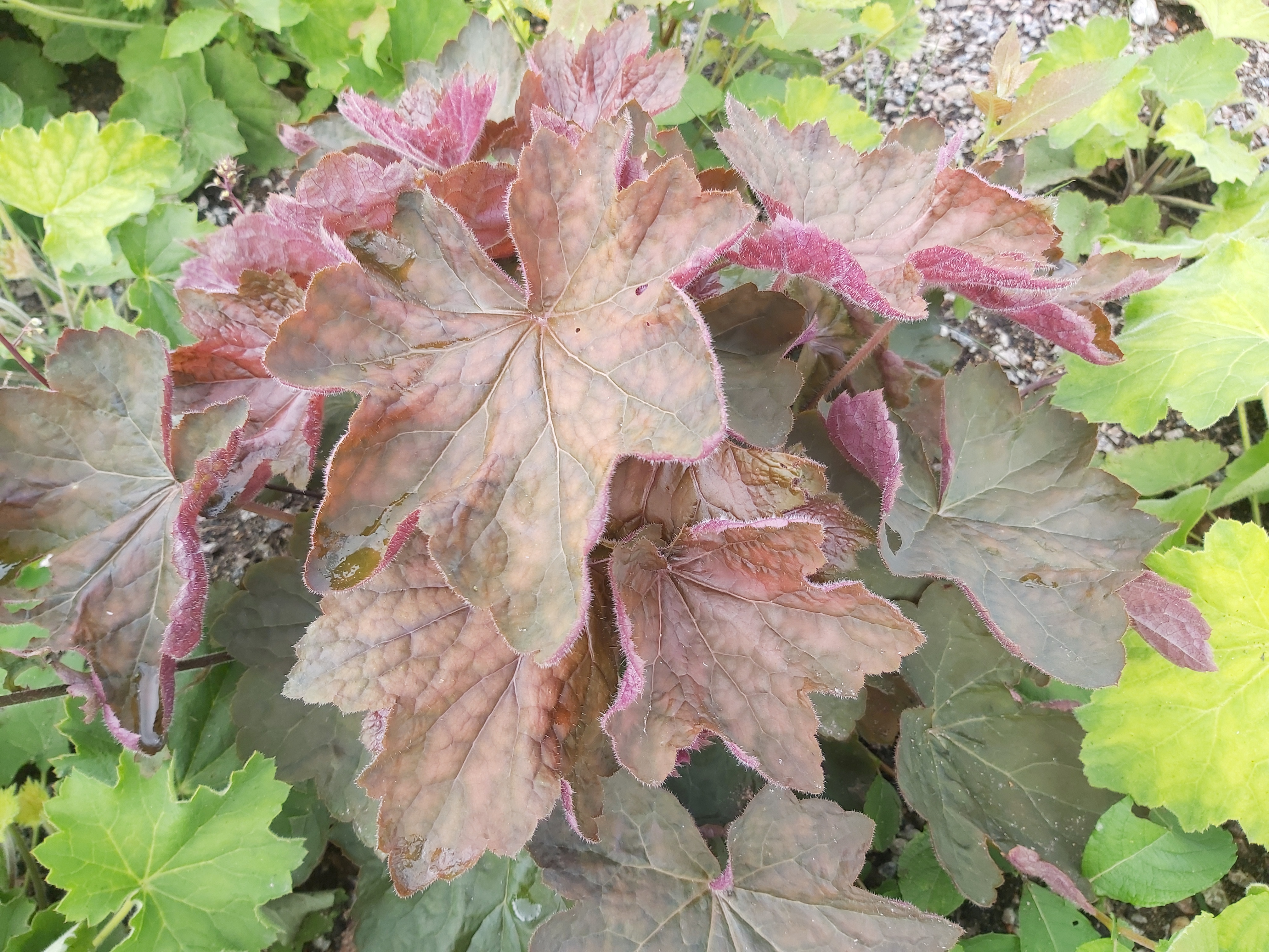
Unknown. |
|
|
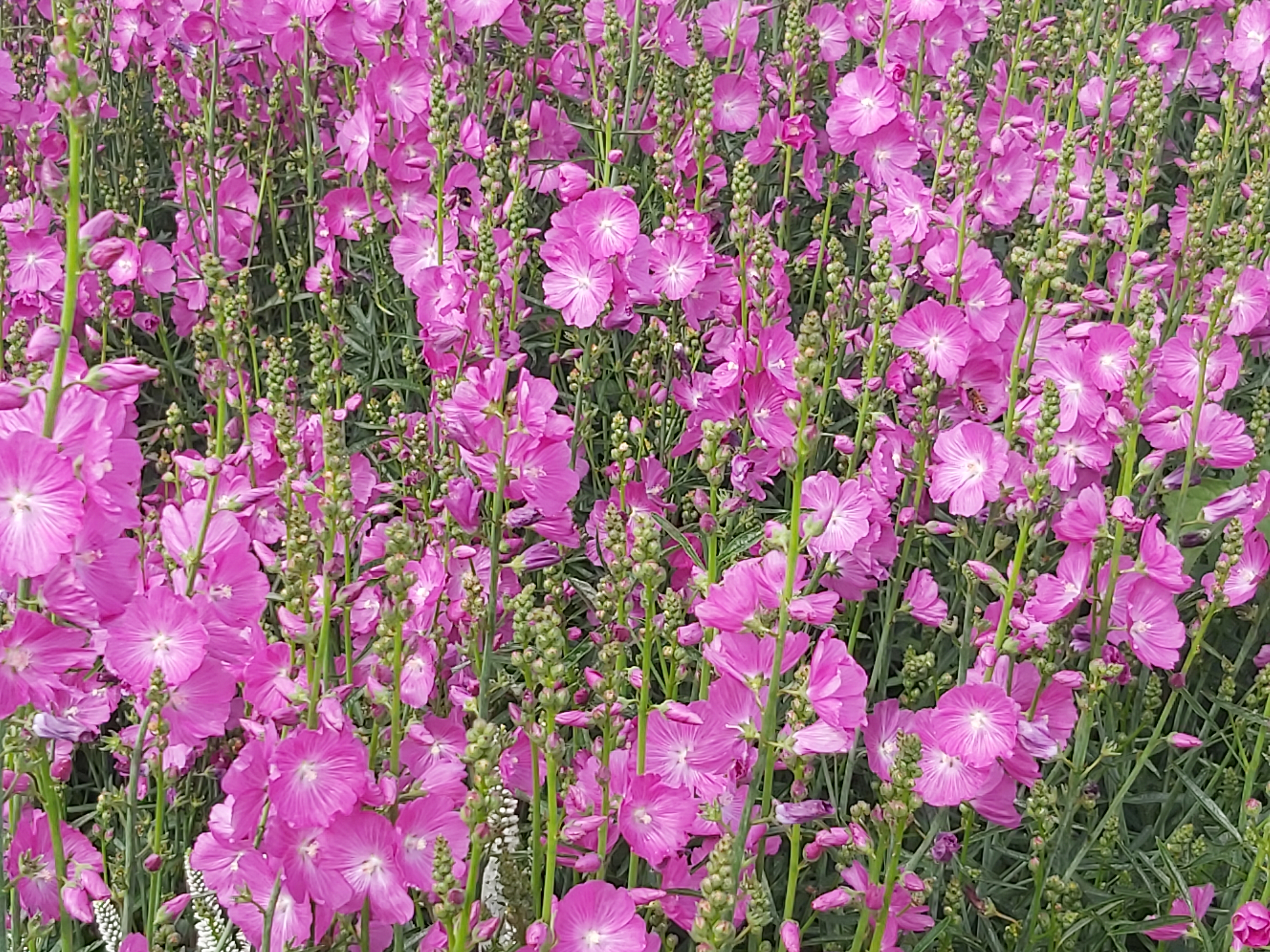
Malva alcea. |
|
|
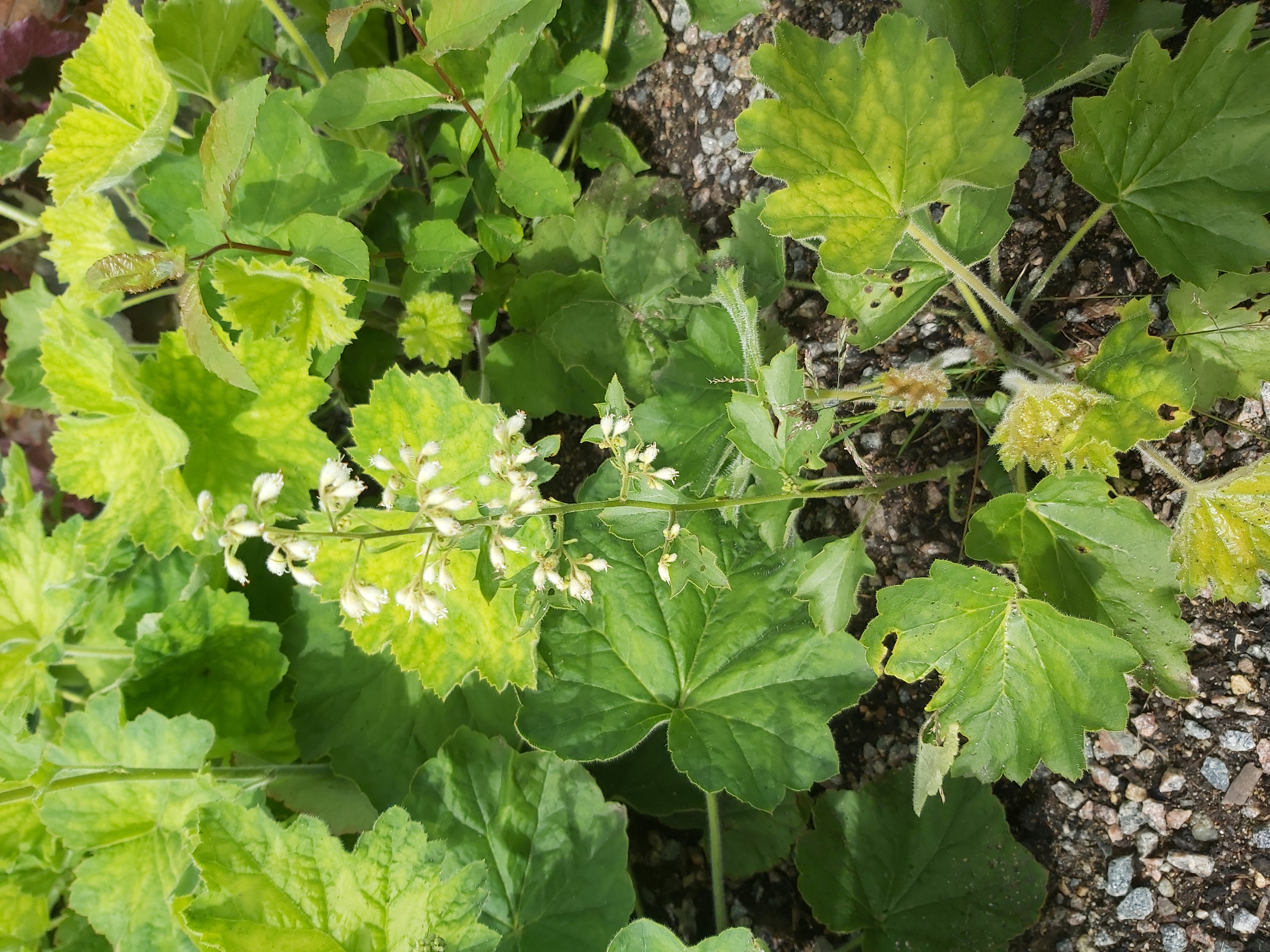
Unknown. |
|
|
Nodding thistle. |
|
|
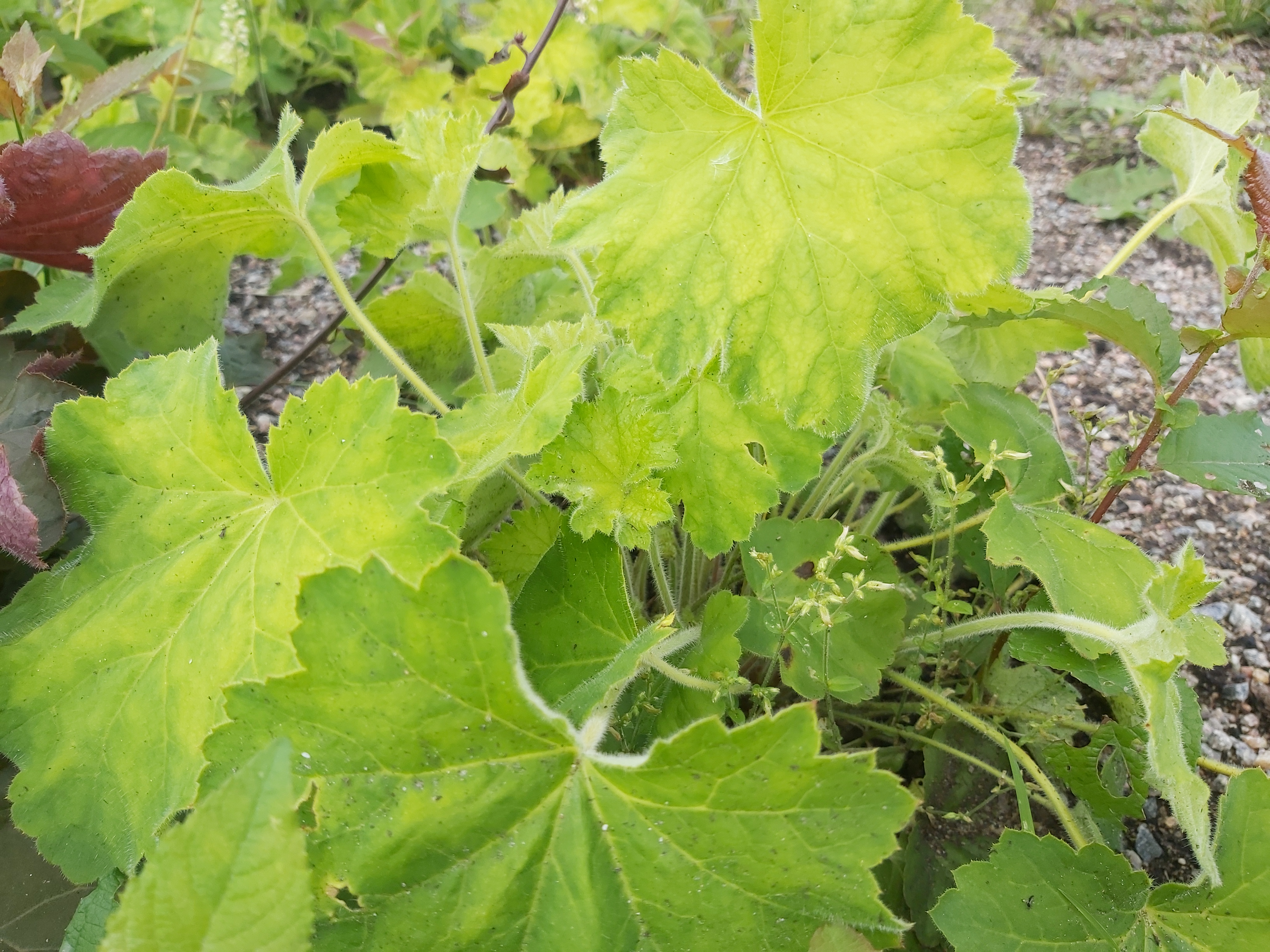
Unknown. |
|
|
Unknown. |
|
|
Unknown. |
|
|
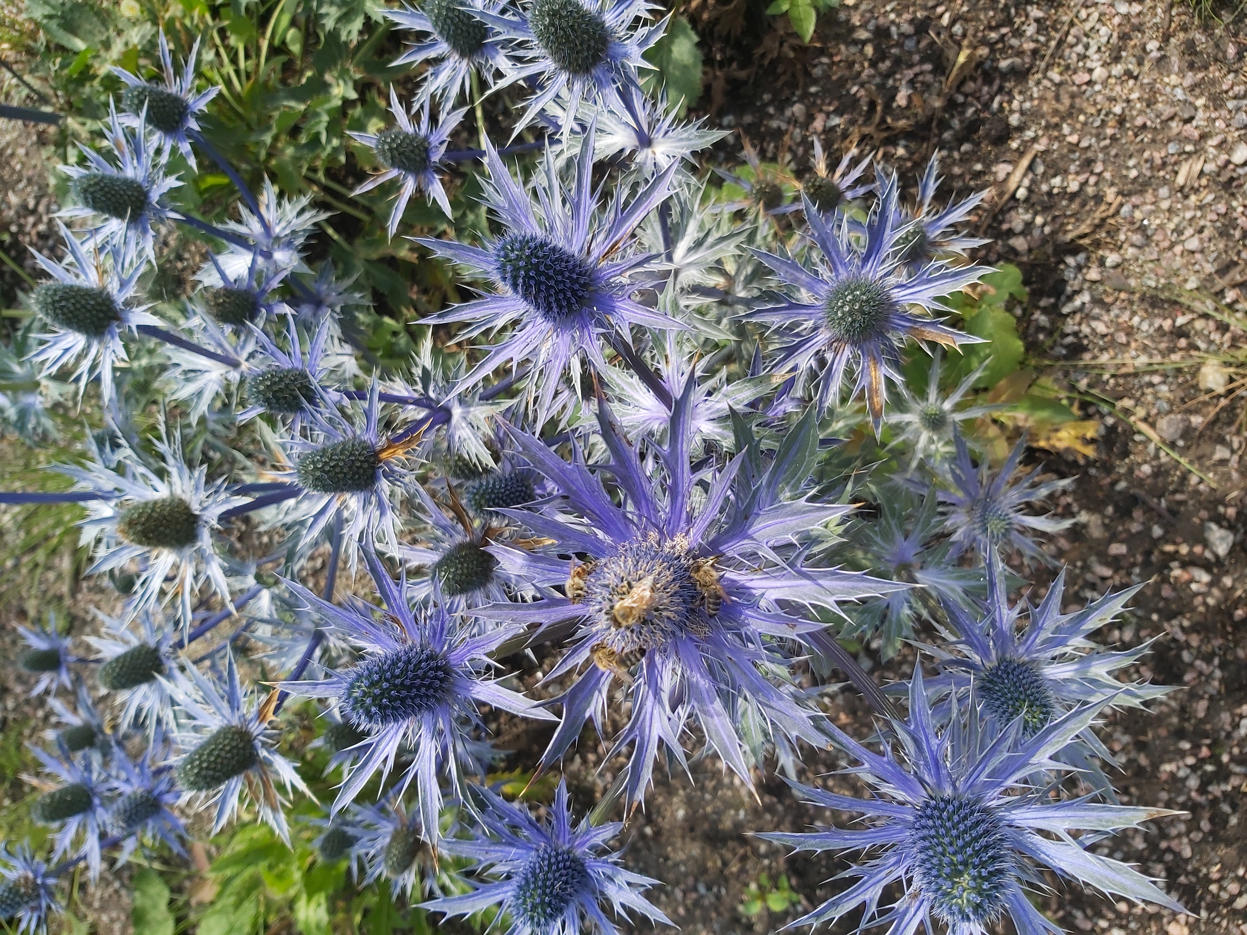
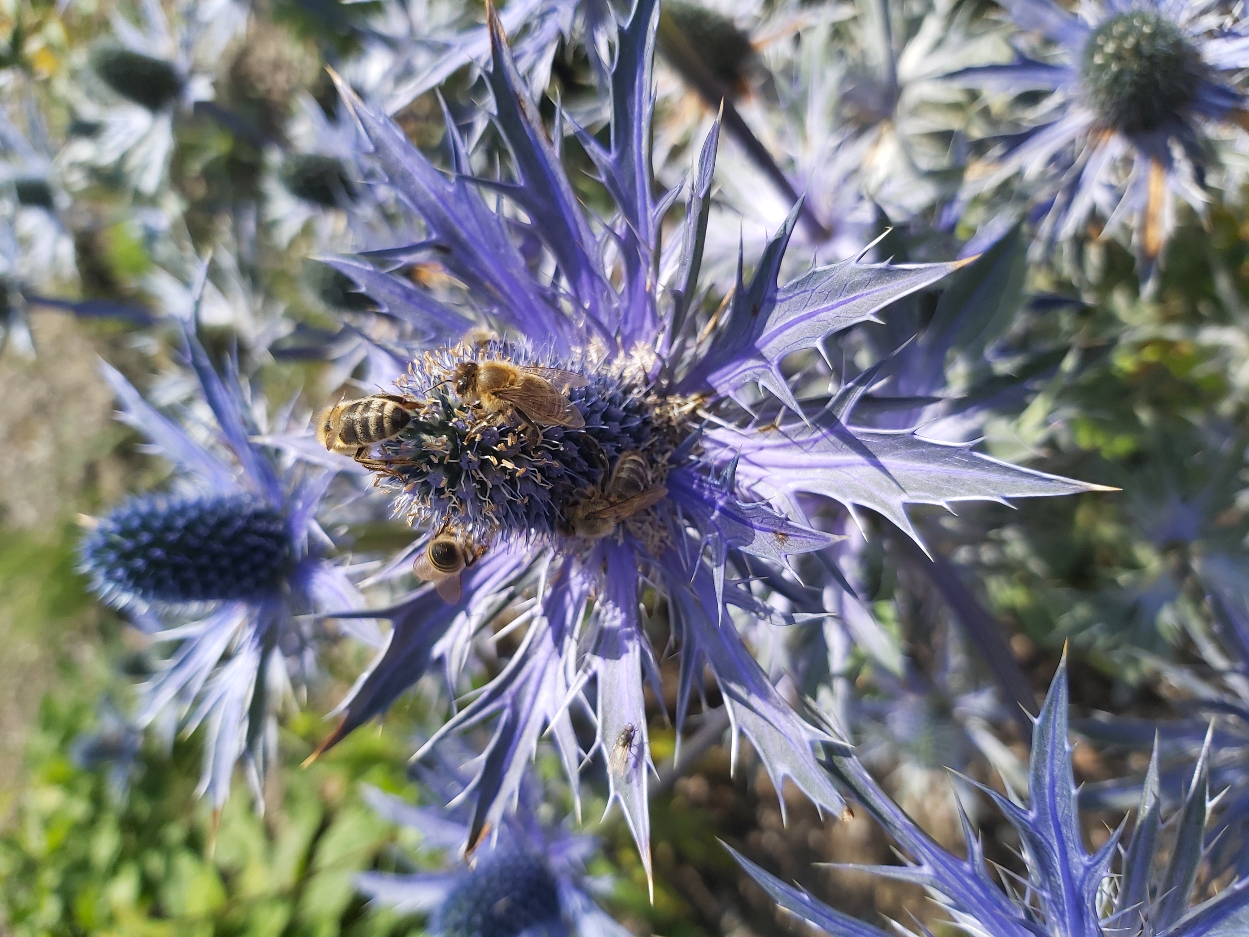
Eryngium bourgatii |
|
|
Cone flower, Echinacea sombrero. |
|
|
Blanketflower, unknown. |
|
|
|
|
|
|
|
|
|


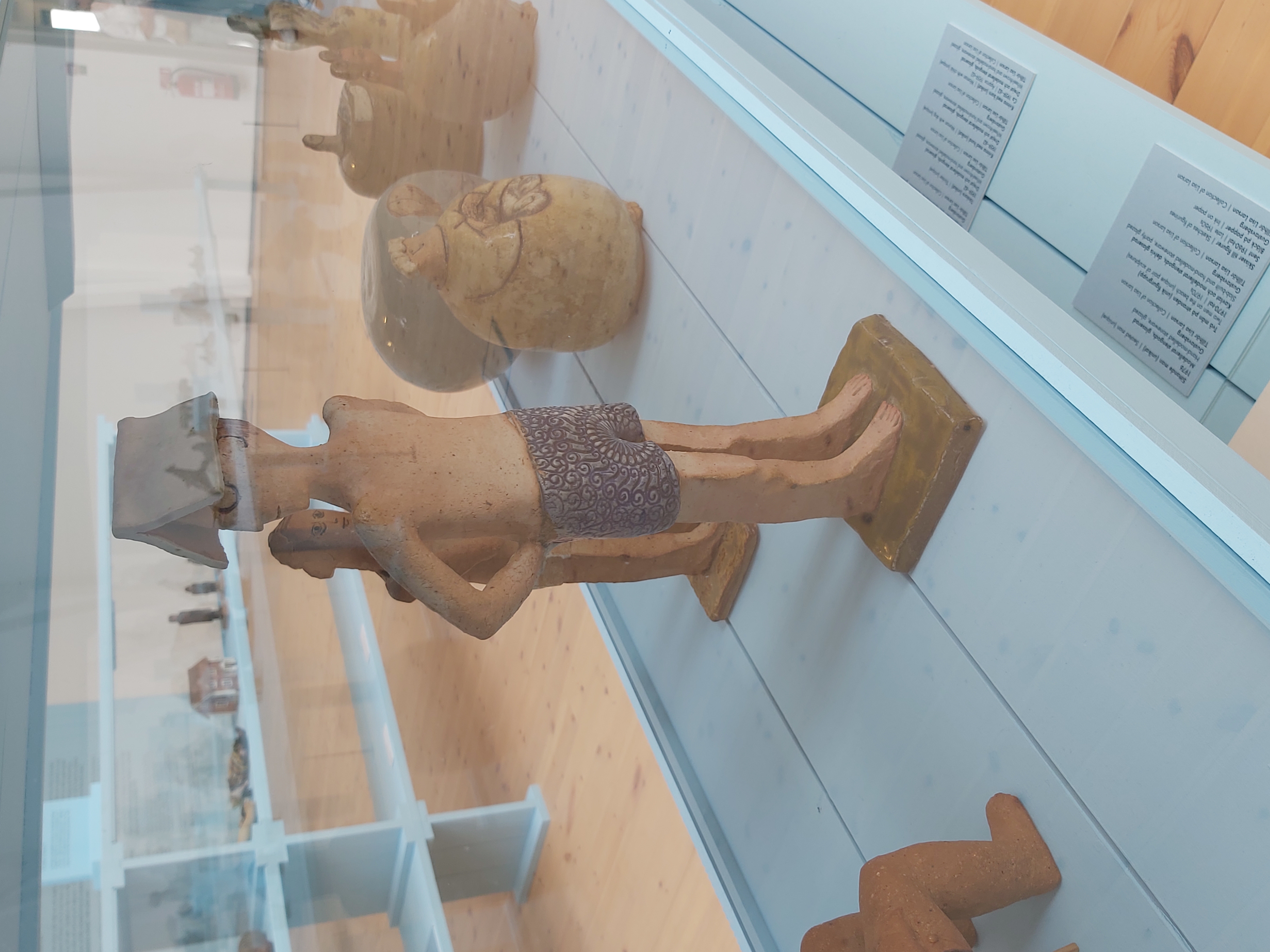
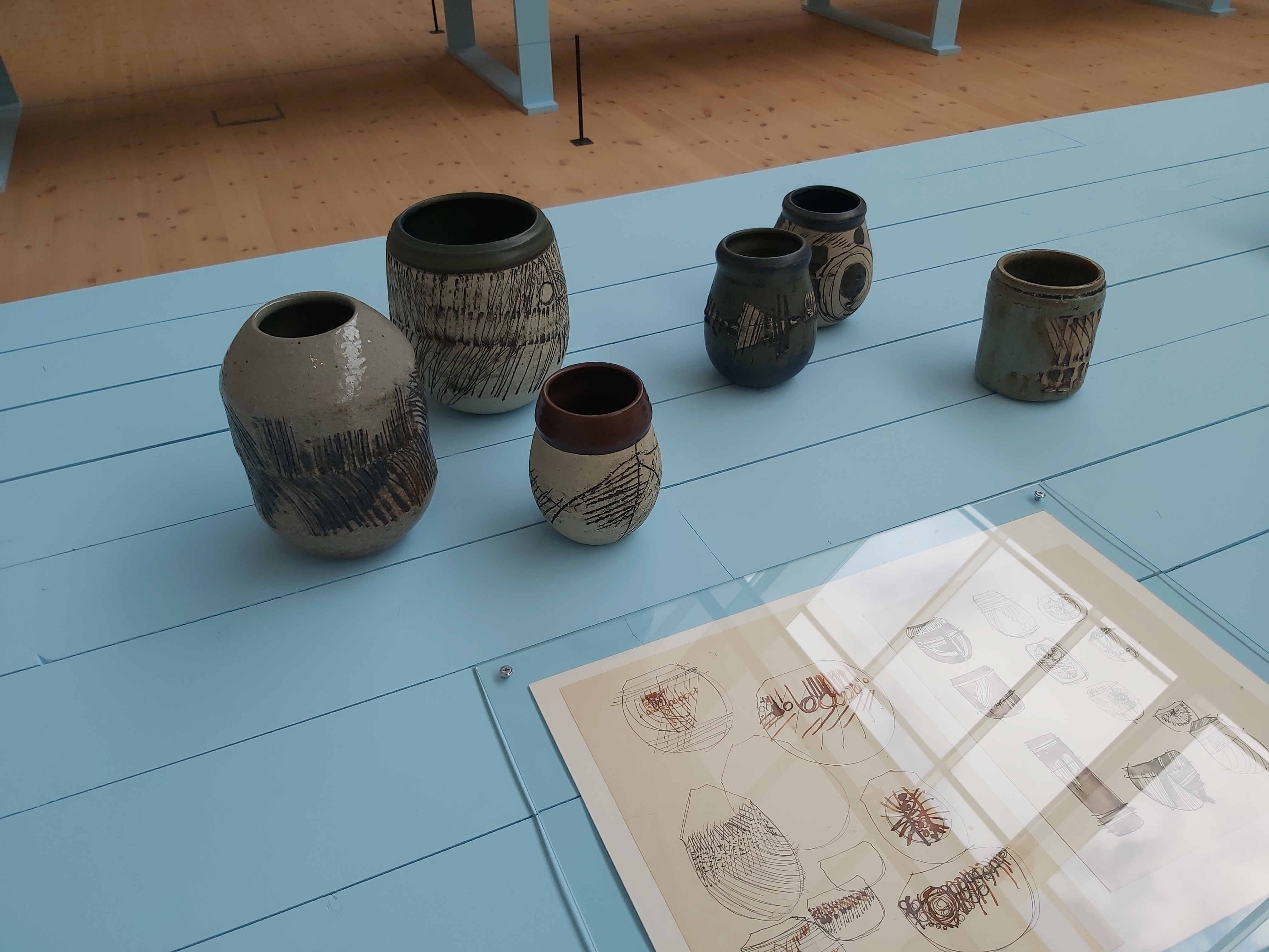
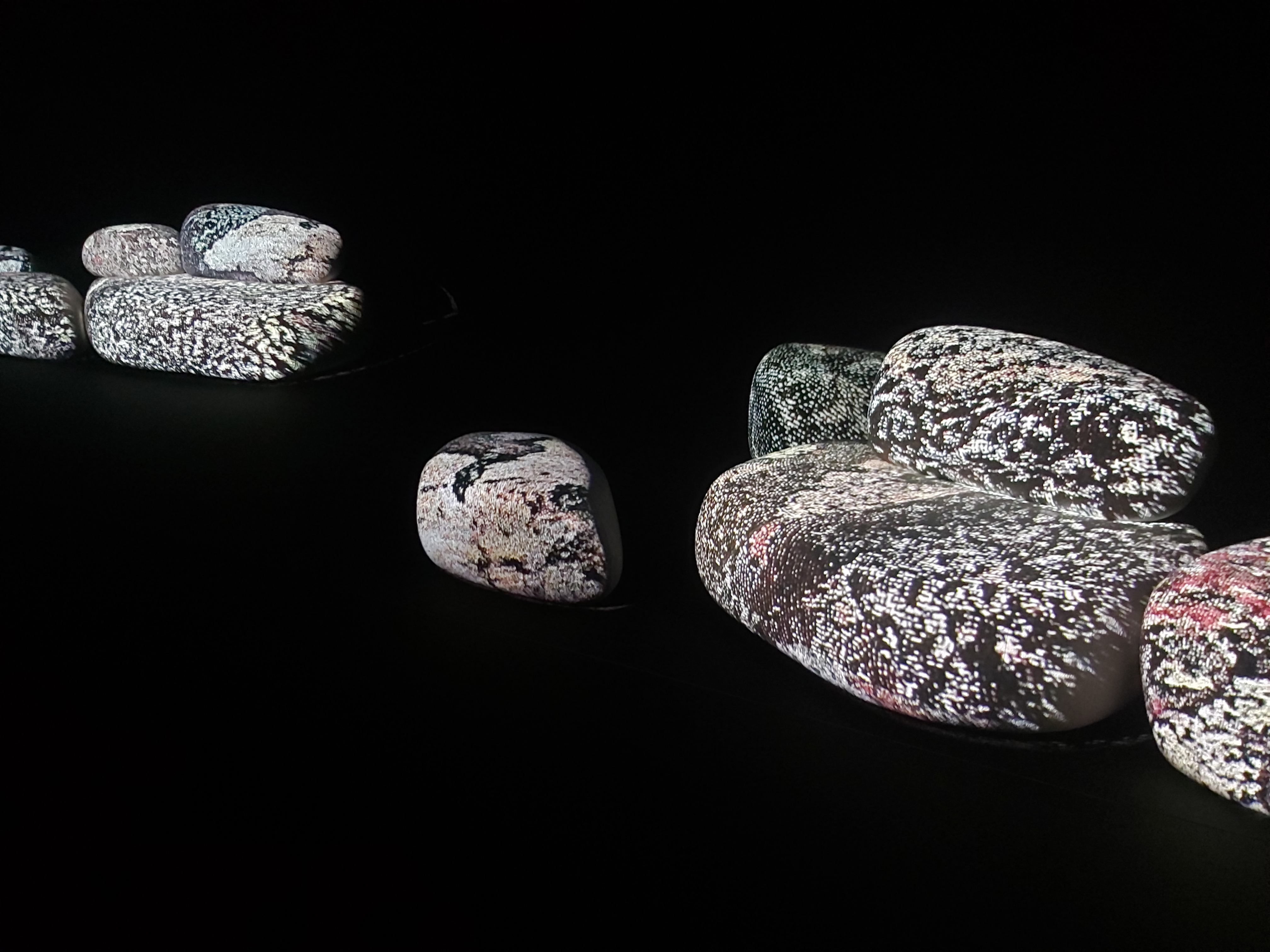
First, we had a meal at the museum restaurant. It was delicious. Then we went to see the three exhibitions: About the ceramist Lisa Larson, The art duo Front, and finally, an exhibition of Amanda Cardell.
|
|
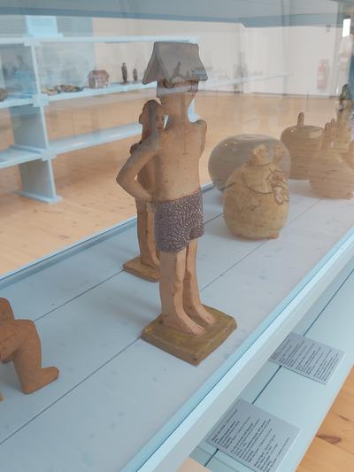
A man with a book as a hat. |
|
|
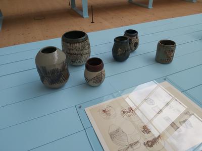
Pots. |
|
|
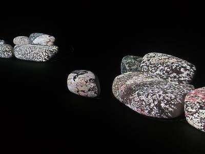
Video beamed on stone-like shapes. Installation by the Duo Front. |
|
|
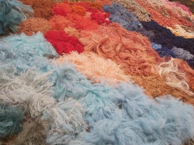
Textile art by Amanda Cardell. |
|
|
|


The exhibitions provided visual impressions. The art in this exhibition did not have a political message screaming out loud to us. Perhaps that gave us a calming effect, something we need during a war in Europe where one part, Russia, actively violates the Geneva Convention, obducting kids, ecocide, destroying cultural sites, and so on. If there were messages in the art, we had to look for them ourselves. For example, I recall being with DF and DM at this museum in February 2018. DF and I debated the dominant diagonal composition rule. This time DF did not want to go to the museum. When I browse my exhibition category, I can conclude it is about time to go to more exhibitions. The pandemic and house-building project have made a significant gap in my cultural consumption.
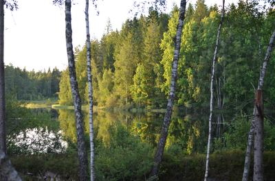
When we came home, we had dinner, and after dinner, we went out to walk around the lake. We brought a bucket for picking huckleberries.
|
|
|
|
|
|
|
|
|
|
|
|
|
|
|
|
|
|
|
|
|
|
|
|


Sunday 6 July
This morning it would be no rain until noon, then it would start raining. I started surveying the north side of the property. Right from the start, I had an issue with the tripod. When I wanted to extend the legs, one leg fell off, and little internal bits fell out. I recovered some of the bits but not all of them, but I did not realize that until later. Then I tried to come back and find the missing part, but that was too small. I hear you think I should have made a high-precision recording of that point so that I could return and continue searching for the missing part, but I did not. I had to ducktape one leg of the tripod. Perhaps I can 3D print the missing part. I have no idea.
The next problem was that I wanted to mark intermediate points with yellow and black tape but not sticky tape. I had not paid attention when I bought the tape; this was the sticky version.
At this point, I was steaming hot and had to remove my sweater and start working. It was overcast weather but dry, which is good because the phone is not okay with droplets. I recorded my way along the border, recorded corner points, etc.
I worked my way back to the cottage when the equipment stopped working. I got permission denied on the NTRIP subscription. I concluded that my subscription had ended prematurely, which was incorrect, but I had no idea. It did not matter because it also started raining so I had to go inside.
While it was raining, I was trying to figure out how to get the base station set up to work. Apparently, one needs to have the U-center software. Not the latest version but the old version. One needed to do all sorts of configuration changes, which was new to me, and I had no clue what I was doing.
After some time, I gave up on the base station setup and started researching how to get the data from the phone back into the computer and a decent CAD program. Ardusimple, selling this survey gear, suggests using QGIS for converting the survey data collected in the SW maps to AutoCad. I installed that. It is not intuitive. I had a rather frustrating afternoon and evening.
Sketchup free is not going to help. Fusion 360 can work with the data but is unaware of what it is doing. The geo location points are just floating numbers. Not ideal.
I searched for reviews of free or more or less free GIS CAD software, and they returned to QGIS. I suppose I have to give it another chance.
Here ends this week's blog; I have been into surveying. It is a challenging area with its own vocabulary. I cannot say I ended the week especially happy with the outcome, but I am nearly there. I think I will need to understand more about the subject, though.


 A week of social activitiesGot all roofboards mounted!Cottage improvementsMax Lieberman exhibition at The Municipal Museum of The HagueSunnerås February 2018Impressionism and beyond. A Wonderful Journey 28 January 2018Thursday 28 December 2017, Amsterdam #7Samantha 3 December 2017Eva 29 October 2017Anna Maria 16 April 2017Gilad 6 December 2015Aleksandra 1 November 2015Jan Sluiters exhibition at Singer Museum Laren 2011 - 2012
 I moved from Sweden to The Netherlands in 1995.
Here on this site, you find my creations because that is what I do. I create.